Listing Category: Rest Area
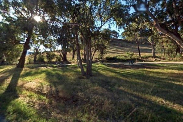
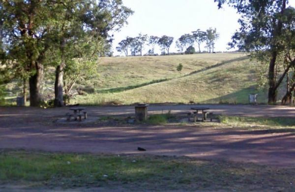
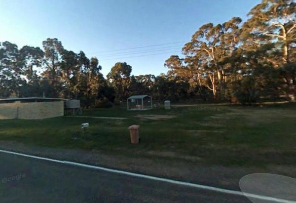
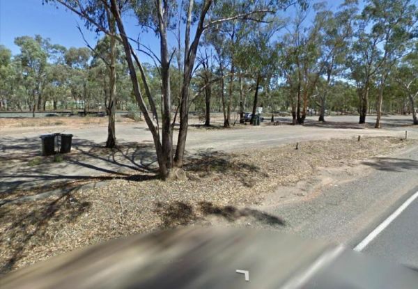
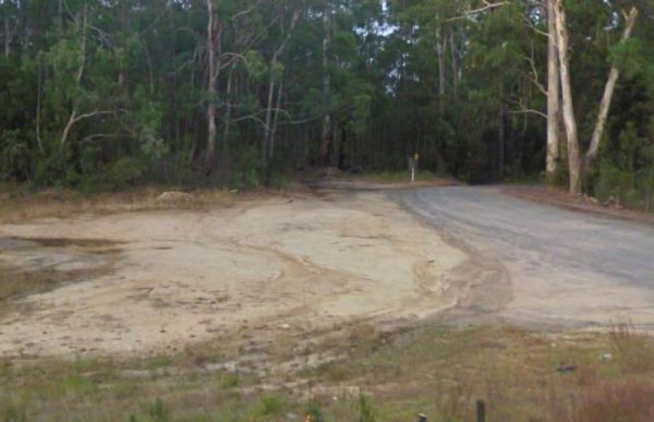
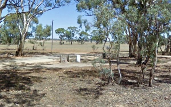
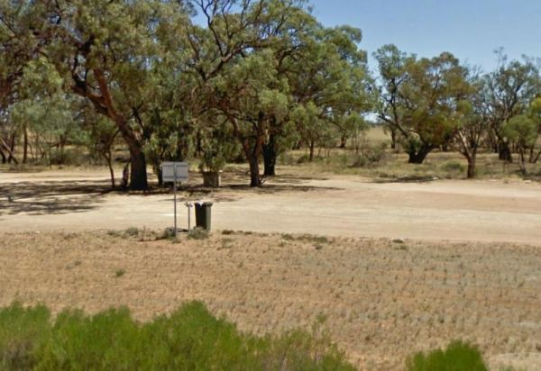
The Agnes River Rest Area is a short walk from the Agnes River which has steep banks, so access is a bit difficult to get to the water. But you can have a BBQ and enjoy the scenery, while resting. Entrance to the Agnes River Rest Area Agnes River Rest ...
 ,
,  ,
,  ,
,  ,
, 
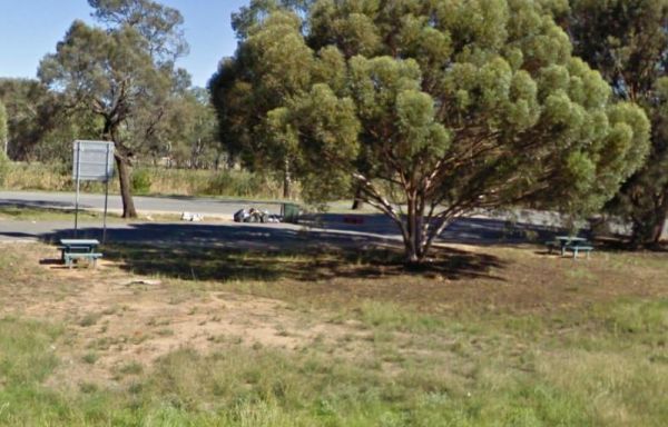
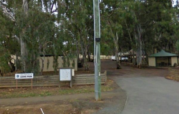
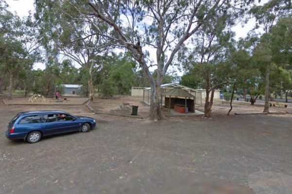
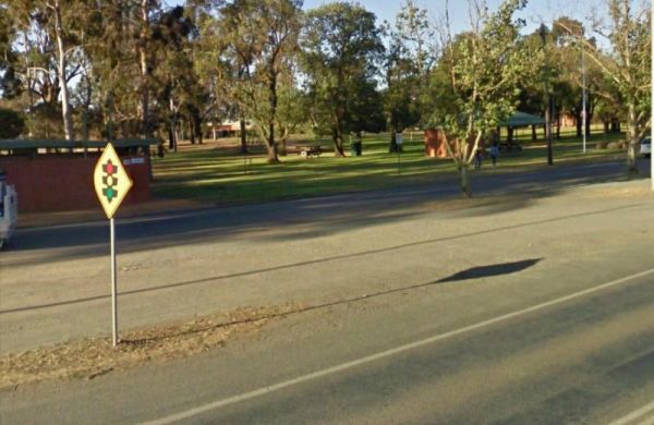
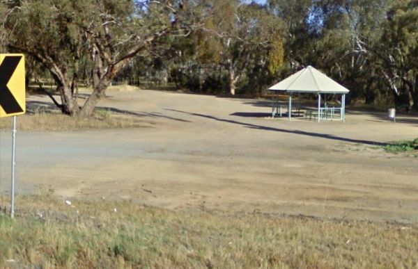
The Anglesea Lions Park Reserve Rest Area has a BBQ with a handy Playground for the kids plus Toilets, and its within easy walking distance to the Anglesea River to catch a meal or watch the boats go by. Entrance to the Anglesea Lions Park Reserve Rest A ...
 , ,
, ,  ,
,  , ,
, ,
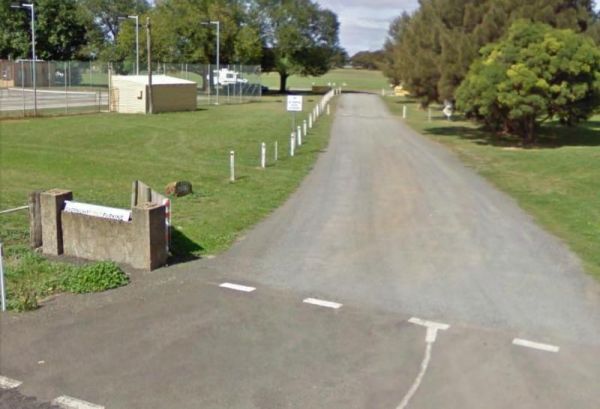
The Apollo Bay Rest Area is a large parking area opposite a Caltex petrol station, so you can pop over the road and grab a cold drink and a few snack foods while you stop here. Entrance to the Apollo Bay Rest Area Apollo Bay Rest Area location map
, ,
The Atkinson Park Rest Area is a well established rest area, you will find a toilet block, undercover BBQs and picnic tables overlooking a small lake. There is plenty of room to park and a few handy rubbish bins as well. Entrance to the Atkinson Park Res ...
, , ,
The Balmattum Rest Area is a large asphaled area with plenty of room for semis and the biggest camping rigs. Here you will also find undercover picnic tables and a few rubbish bins, plus a toilet block. Entrance to the Balmattum Rest Area (Northbound) ...
, , , , 
The Barnadown River Reserve on the banks of the Campaspe River, this is a nice spot for a break from driving and a place you might catch a fish for dinner. Entrance to the Barnadown River Reserve Barnadown River Reserve location map
, , ,
The Barwidgee Rest Area is a large grassy area set on the banks of the Barwidgee Creek. You can try your hand at fishing here or take your camera and explore a few of the rock pools along the creek. Entrance to the Barwidgee Rest Area Barwidgee Rest A ...
, ,
The Bass Valley Reserve Rest Area. This is a nice spot with quite a bit of room to park your caravan. There is an onsite toilet, and a few picnic tables set among the gum trees. THE LOCAL COUNCIL HAS PERMANENTLY CLOSED THIS REST AREA Entrance to the ...
, , ,
The Bears Lagoon Fruit Fly Rest Area has a few picnic tables and rubbish bins and plenty of space to park. For those you like fishing, you are parked next to Bears Lagoon, so you might be able to wet a line while you rest here for a bit. Entrance to the ...
, ,
The Beau Morton Park Rest Area is adjacent Racecourse lake and there are a few trees for shade. Here there is enough room to pull over with your caravan and take a break from driving. Entrance to the Beau Morton Park Rest Area Beau Morton Park Rest Ar ...
, , , ,
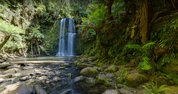
The Beauchamp Falls Reserve is quite popular, so expect a few neighbours when you camp here. The main attraction is the 20 metre high Beauchamp Falls, but you will need to hike approximately 40 minutes or so, to get there so your camera is a must have ite ...
The Beazleys Bridge Rest Area is just off the Ararat-St Arnaud Road, opposite the Beazly Public Hall, it's a nice shady spot to take a break from driving and grab a bite to eat. Here you will find a picnic table, some shade, and not much else. Entrance t ...
The Bellbird Creek Rest Area is next to the Bellbird Hotel, so you can pop in for a counter lunch, and cold beverage while your taking a short break from driving. Entrance to the Bellbird Creek Rest Area Bellbird Creek Rest Area location map
,
The Benalla North Truck Parking Rest Area Northbound is a large area suitable for all sized rigs. There are toilets onsite and undercover picnic tables, also a few rubbish bins here and there. Entrance to the Benalla North Truck Parking Rest Area (Northb ...
, , ,
The Berriwillock North Rest Area is basically wedged on the edge of the Calder and a train line, this is definitely a stop if your tired spot for sure. Nothing to do but watch the traffic go by while your resting up. Entrance to the Berriwillock North Re ...
,
The Berriwillock Tynan Park Rest Area is next to a large grain store located next a railway track.This is a very large gravel area, and its worth a stop to take a photo of the grainery, and a visit to the local pub. Plus there is a public toilet next to t ...
, ,
The Blind Joe Creek Rest Area is a No Camping area. There is a toilet onsite and a few rubbish bins, also there is plenty of room to maneuver your caravan or motorhome. For those who like to fish small creeks, don't waste your time here, the creek often r ...
, , ,
Boundary Bend East Park Rest Area has a toilet and is on the banks of the Murray River. Along with picnic tables and BBQ's it's not a bad spot to pull over and take a break from driving. Entrance to the Boundary Bend East Park Rest Area Boundary Bend ...
, , ,
The Branxholme Rest Area is an ideal rest area, with excellent shady areas on the highway. The shady parking bay on the highway has been developed as a commemorative area for soldiers lost during Work War One. Byaduk is home to the magnificent Byaduk cave ...
, , ,
The Bridgewater on Loddon Rest Area has a public toilet, and plenty of room to park your camping rigs. Entrance to the Bridgewater on Loddon Rest Area Bridgewater on Loddon Rest Area location map
, , ,
The Brightlight Saddle Rest Area is just off the Princes Highway and has plenty of shade. There are two picnic tables and a rubbish bin so you and take a break from driving and have a picnic and watch the traffic go by. Entrance to the Brightlight Saddle ...
The Bundalong Rest Area is just off the Murray Valley Highway, there is plenty of shade to park under, and at least two picnic tables and one rubbish bin. You can sit in the shade at a picnic table and watch the traffic go by while having a picnic at the ...
,
The Bung Bong Rest Area has an Old Anglican church onsite, and its carpark is now the rest area. Stretch your legs and can take a walk around the decommissioned church which has a date inscription above the door showing 1876. Entrance to the Bung Bong Re ...
,
The Bunyip River Rest Area Set back a short distance from the Princes Freeway, There is a BBQ and a few picnic tables you can also let the kids and dog run without fear of them getting run over. You can also go for a walk in the Bunyip G13 Streamside Rese ...
, , , , ,
The Burnt Creek Rest Area is set a short distance away from the Western Highway. There are picnic tables available and plenty of shady spots to park. It's safe to let the kids and your pet dog stretch their legs here. Entrance to the Burnt Creek Rest Are ...
,
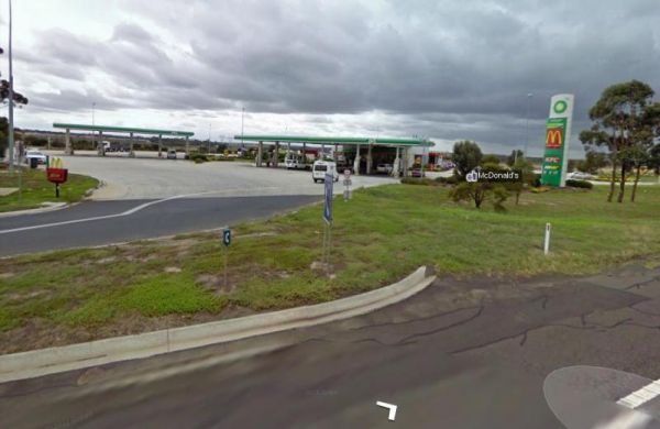
The Calder Inbound Rest Area Southbound Only is a convenient stop for a short break on a long drive heading into Melbourne. Here you can fuel up your vehicle and get some food for yourself. Entrance to the Calder Inbound Rest Area Southbound Only Cald ...
, ,
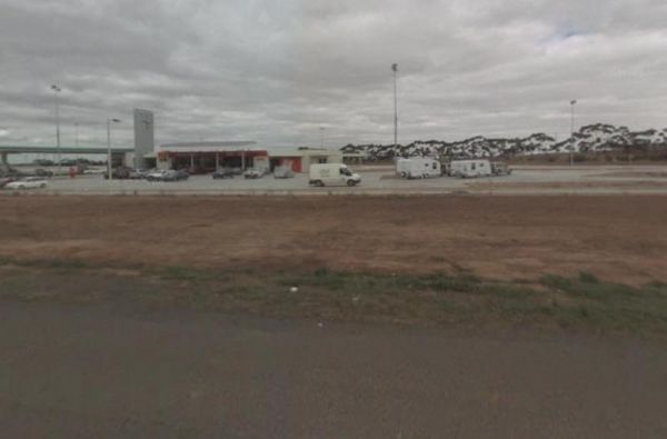
The Calder Outbound Rest Area Northbound Only, the fuel prices seem to be always higher than other fuel stops on your way to Bendigo. Showers also on site and public restrooms. Entrance to the Calder Outbound Rest Area Northbound Only Calder Outbound ...
, ,
The Calder Woodburn Memorial Rest Area is accessed from Dawson Road, and the turn off is easily missed, but if you do get the turnright, you will find a couple of picnic tables only metres away from the Goulburn Valley Highway, seperated with a wire prote ...
,
The Canadian Gully Bushland Reserve Rest Area is next to a small dam so you should be able Catch a yabbie or two for the tucker bag. Entrance to the Canadian Gully Bushland Reserve Rest Area Canadian Gully Bushland Reserve Rest Area location map
, , ,
The Cann River Rest Area is a long slightly raised area running alongside the Princes Highway, Not much to do here, apart from take a power nap, and then be on your way again. Entrance to the Cann River Rest Area Cann River Rest Area location map
The Casey Weir Rest Area is set well back from the Midland Highway and next to the Broken River. From this rest spot its only a short walk to the Weir itself, so take your dog and camera along to stretch your legs. Entrance to the Casey Weir Rest Area ...
, , ,
The Casterton Park Rest Area is on the banks of the Glenelg River, and only a short walk away from the Glenelg Inn, and the heart of town. Entrance to the Casterton Park Rest Area Casterton Park Rest Area location map
, , ,
The Cathcart Rest Area is a shaded spot to pull over and it's not far from Ararat. It's a good place to pull over then work out your next destination. Entrance to the Cathcart Rest Area Cathcart Rest Area location map
,
The Cherrypool Park is next to the Glenelg River. with room to maneuver and places to park along this dirt road. You can try your hand at fishing or grab a camera and stretch your legs. If your in need of the toilets you have a around half a kilometer to ...
, , ,
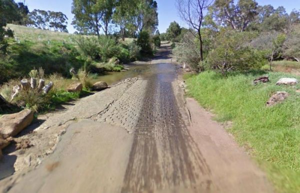
The Cherrypool Park Rest Area is next to Cherrypool waterhole on the Glenelg River. There are toilets here and a wash basin and tap. Also plenty of room to maneuver with your caravan attached. This park has a few entrances and the picnic tables are locate ...
, , ,
The Chiltern Park Rest Area has separate truck parking bays, so please respect them by not causing problems for the truckies who use this site. Entrance to the Chiltern - Ironbark Rest Area Chiltern - Ironbark Rest Area location
, , ,

The Clarendon Rest Area iset a short distance back from the Midland Highway, with a few picnic tables and rubbish bins and plenty of trees to keep the sun off you. Its alright for a break from driving, and catch up on some rest. Entrance to the Clarendon ...
,
The Club Terrace Rest Area is on the side of the Princes Highway. This rest spot has a few picnic tables so you can take a break from driving and have a bite to eat while watching traffic go by. Entrance to the Club Terrace Rest Area Club Terrace Rest ...
The Coach Road Rest Area has separate parking bays for caravans and trucks, plus some undercover picnic tables & seating. This rest area is set back a short distance from the freeway. Entrance to the Coach Road Rest Area Coach Road Rest Area locat ...
, , ,
The Cobbledicks Ford Reserve is close to the Werribee River, and is a historic site and river crossing which has bluestone pavers laid across it. Entrance to the Cobbledicks Ford Reserve Cobbledicks Ford Reserve location map
, , ,
Entrance to the Corryong Park Rest Area Corryong Park Rest Area location map
, ,
The Culgoa South Rest Area is just off the Calder Highway, with BBQs and picnic tables, and some shade to make your break from driving a bit more bearable. There are also some rubbish bins onsite. Entrance to the Culgoa South Rest Area Culgoa South Re ...
, , ,
The Cullulleraine Rest Area is just off the Sturt Highway and there's not much to do here, but sit down at the picnic tables and watch the traffic go by. There are also couple of rubbish bins are also provided. Entrance to the Cullulleraine Rest Area ...
A place to pull over when your'e tired is the Dadswells Bridge South Rest Area.Here there is a bit of shade a few picnic tables plus a few rubbish bins. This rest area is on the Western Highway and nothing much to see here. Entrance to the Dadswells Brid ...
The Dartmoor Turnoff Rest Area has a picnic table and fireplace. This rest area covers quite a large area so parking won't be a problem. There are pine forest plantations almost in every direction you look, so this is a little Gum Tree oasis. Entrance to ...
,
The Dederang North Rest Area is on a raised embankment adjoining the Kiewa Valley Highway. Pull over here and take a break from driving. Entrance to the Dedarang North Rest Area Dedarang North Rest Area location map
The Derrinallum Recreation Reserve Rest Area is a free camp for 24 Hours only. There are a few trees for shade, rubbish bins, a toilet block, and playground onsite. This is also a dog friendly stopover. Be sure to spend some money in town to help fund the ...
, , , , 
Dobie Highway Park is Set a fair way back from Dobie Road with the Hopkins River (sometimes it even has water in it) not far from this spot. it's worth a stretch of the legs and camera in your hands to check out if there is any water in the river. Entran ...
,
The Dodds Bridge Rest Area is set amongst tall gumtrees. The Holland Creek runs in winter only, so fishing is really not an option here. Entrance to the Dodds Bridge Rest Area Dodds Bridge Rest Area location map
Ellis Bridge Rest Area is on the banks of the Mitta Mitta River and has a 24 Hour Limit for those staying overnight here, There is a picnic table here for your convenience. Entrance to the Ellis Bridge Rest Area - 24 Hour Limit Ellis Bridge Rest Area ...
, ,
The Elmore Highway Park Rest Area is a nice spot to stop. It's set well back from the Northern Highway with lots of space. There are no facilities but it's close to the Campaspe River for fishing and photography enthusiasts. Entrance to the Elmore Highwa ...
, , ,
Elphinstone North Rest Area runs along the Harmony Way, it has picnic tables and fire places. So it's a place to pull over and have picnic and cook a few things on the fireplace. Entrance to the Elphinstone North Rest Area Elphinstone North Rest Area ...
, ,
The Ensay South Rest Area is a small area next to the Great Alpine way, and on the banks of the Tambo River. Make sure you've got your fishing gear, you never know your luck. Entrance to the Ensay South Rest Area Ensay South Rest Area location map ...
, , ,
The Everard Park Streamside Reserve next to Yarra River has a 600m loop walk, from the car park along the river bank. There are 2 swimming spots, and one is quite shallow and has hardly any current at all. Entrance to the Everard Park Streamside Reserve ...
, ,
The Fitzroy River Streamside Reserve Rest Area has a few spots to choose from along the Fitzroy River waterfront. Here you'll find a few fireplaces and a few picnic tables. Entrance to the Fitzroy River Streamside Reserve Rest Area Fitzroy River Strea ...
, ,
The Flynn Rest Area heading west, its roughly halfway between Rosedale and Traralgon East. This rest stop has a fair amount of room, so it can accomodate all rig sizes. Entrance to the Flynn Rest Area Flynn Rest Area location map
,
The Freshwater Lake Rest Area is set well back from the Victoria Valley Road, and in amongst some trees. There is plenty of room to manoeuvre your caravan to find a good park and a rest from driving. Entrance to the Freshwater Lake Rest Area Freshwate ...
,
The Genoa Rest Area is a nice peaceful spot to stop for a few days, there is a maximum of 72 Hours stopover. This campsite has toilets and cold showers, and is located next to the Genoa River. Please consider leaving a donation onsite to help maintain thi ...
, , , ,
The Gisborne North Bound Rest Area has plenty of room to park for all sized rigs. Toilets are onsite and a few rubbish bins and picnic tables make this a good spot to pull over and take a break from driving. Entrance to the Gisborne Northbound Rest Area ...
, , ,
When nature calls the Gisborne Southbound Rest Area is perhaps not for first port of call, but if you can't wait its a spot to pull over. Entrance to the Gisborne Southbound Rest Area Gisborne Southbound Rest Area location map
, , ,
The Glenelg River Rest Area is a large parking area next to the Glenelg River. There are some fixed BBQ's, you will need to bring your own firewood to use them, plus there are a few picnic tables so you can enjoy a break from driving. With the river close ...
The Glenpatrick Recreation Reserve will be closed until further notice to allow for restoration of buildings and the removal of 3 trees and pruning of the remaining 100 year old commemorative pine trees. Entrance to the Glenpatrick Recreation Reserve ...
, , ,
The Governors Bend Rest Area is a bit tight for caravans and large motorhomes, and no facilities when you do park here. So as the name implies, it's a place to have a break from driving. Entrance to the Governors Bend Rest Area Governors Bend Rest Are ...
Entrance to the Granite Creek Rest Area Granite Creek Rest Area location map
,
The Grantville - Picnic BBQ Area has a large area next to the jetty for parking any sized caravan. Flushing toilets are located here as well. If you want to fish at low tide from the jetty, you will need to rethink this, as low tide will reveal extensive ...
, , , , ,
The Grass Trees Rest Area Northbound has plenty of parking for all sized rigs. Undercover bbqs and picnic tables with tank water, Public toilets, and rubbish bins. There is also a short looping walking track of approx 0.6km to show the local indigenous Gr ...
, , , ,
The Gre Gre South Rest Area is located on the corner of the Wimmera Highway and McPherson Road. This rest stop is set amongst trees and has a few picnic tables and has a few rubbish bins. The Avon Creek is just behind this spot but hardly any water in it, ...
,
The Great Western Rest Area is on the corner of the Western Highway and Bests Road with the seasonal Concongella Creek behind it. This rest area has a reasonably large gravel parking area, with rubbish bins, and a few picnic tables set under the trees. E ...
,
The Gumbuya Rest Area is opposite Rankins Nursery, You could pop into Gumbuya Park while your in the Area, You will pass it on your way to the Gumbuya Rest Area Entrance to the Gumbuya Rest Area Gumbuya Rest Area location map
, ,
The Gunbower Park Rest Area has toilet facilities and is next to the Gunbower Creek.So why not take a stroll and check it out, or drop your kayak in for a better look.There is also a children's playground right next to the toilets to keep the kids amused. ...
, , , , ,
The Happy Jacks Recreation Reserve has the Bullock Creek just behind the reserve if you want to check it out with your camera. Entrance to the Happy Jacks Recreation Reserve Happy Jacks Recreation Reserve location map
, , ,
Heritage Park is on the banks of the Yarra river so kayaking fishing etc is available here. I personally would not take a caravan down the access road as it gets a bit tight to turn around, if other vehicles are there. Heritage Park location map
, , ,
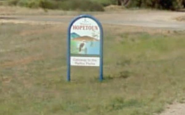
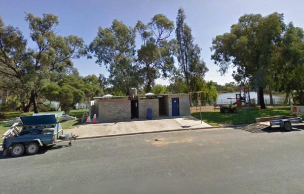
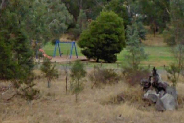
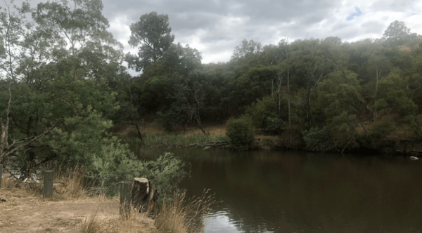
The Hopetoun Free Dump Point has now been installed into the rest area, its been set for the truckies that use this rest spot. Entrance to the Hopetoun - Free Dump Point Hopetoun - Free Dump Point location map
,  , ,
, ,
The Hospital Creek Rest Area is next to the Hospital Creek and just off the Princes Highway, It's a nice spot to take a break from driving and have a BBQ. Entrance to the Hospital Creek Rest Area Hospital Creek Rest Area location map
, ,
The Howitt Park is a great place to pull over, it has plenty of room for big vans etc clean toilets, fishing is good there is a boat ramp, also a large slippery yellow slide for the kids, a flying fox and a normal playground. Entrance to the Howitt Park ...
, , , ,
The Huntly Lions Park Rest Area allows Free overnight stays, has town water, a toilet block and room to park your van, and is located next to Back Creek. Entrance to the Huntly Lions Park Rest Area Huntly Lions Park Rest Area location map
, , ,
The Indigo Creek Rest Area is set back amongst some tall gum trees, with a few picnic tables and a place rest a bit. Entrance to the Indigo Creek Rest Area Indigo Creek Rest Area location map
,
The Inglewood East Rest Area is located on the edge of the Calder Highway, with a couple of trees and a picnic table, so yo can sit and watch the traffic go by. Entrance to the Inglewood East Rest Area Inglewood East Rest Area location map
,
Entrance to the J.Sloane Park Rest Area J.Sloane Park Rest Area location map
, , ,
The JC Stretch Memorial Park Rest Area is located next the Woady Yaloak River and Overnight stays are permitted here. Entrance to the JC Stretch Memorial Park Rest Area JC Stretch Memorial Park Rest Area location map
, , , ,
The Jessie Kennedy Reserve Rest Area is next to the Campbells Creek with a few picnic tables to have a bite to eat on. This is not the quietest of place to rest, as it is next to Midland Highway. Entrance to the Jessie Kennedy Reserve Rest Area Jessie ...
, , ,
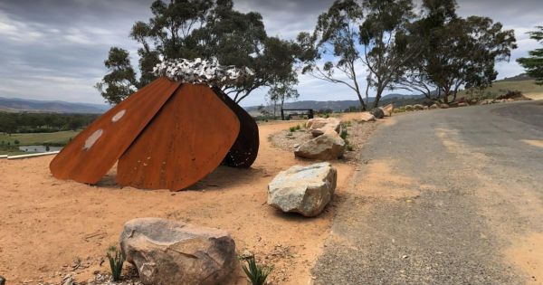
The Jim Newman Rest Area is a fairly large parking area suitable for all sized rigs. There is a Steel Sculpture as its centerpiece and two tables with seating. Jim Newman Rest Area Entrance to the Jim Newman Rest Area Jim Newman Rest Area location ...
, 
The Jock Comini Memorial Rest Area is currently undergoing a few changes and being modernized, there will be dedicated truck parking bays, and a seperate area for cars. Jock Comini Memorial Rest Area Entrance to the Jock Comini Memorial Rest Area J ...
Entrance to the Kangaroo Flat Park Area Kangaroo Flat Park Area location map
, , , , ,
The Katamatite Lions Memorial Park Rest Area is a nice spot to pull over and have a BBQ spot, and its next to the Boosey Creek, its not a bad spot to take a break from driving. Entrance to the Katamatite Lions Memorial Park Rest Area Katamatite Lions ...
, ,
The King Parrot Creek Rest Area is a large gravel area set back from the Goulburn Valley Highway that can handle all sized rigs. You can try your hand at angling here or take a few photos. Entrance to the King Parrot Creek Rest Area King Parrot Creek ...
, ,
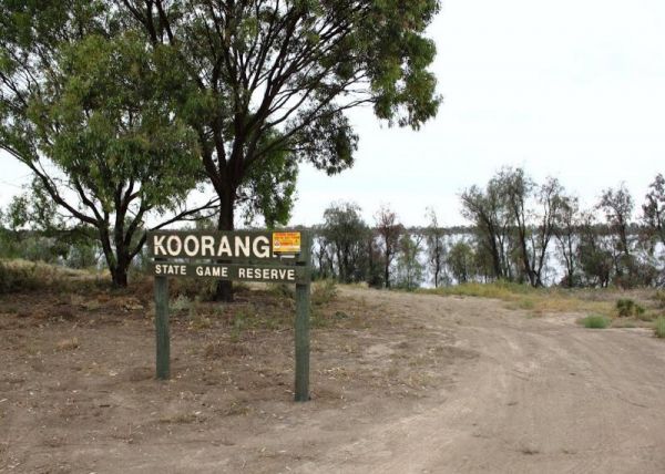
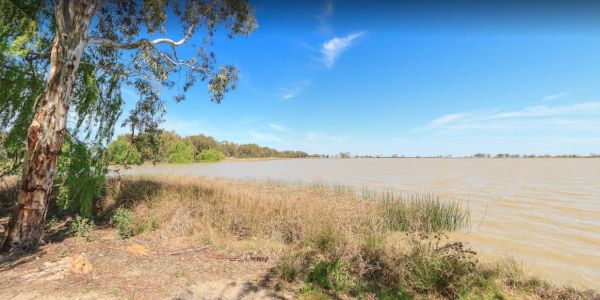
The Koorangie Game Reserve Water levels in the lake vary quite a bit, so don’t expect to be able to do water related activities in a dry year. Koorangie Game Reserve location map
The Kooreh Hall Rest Area is a gravel loop road just off the Wimmera Highway. The hall was built in 1923, as a tribute to the lost soldiers of the Boer, and First World Wars. Entrance to the Kooreh Hall Rest Area Kooreh Hall Rest Area location map
, , ,
The Koriella Rest Area jis ust off the Goulburn Valley Highway with plenty of shade, a place to it down, a rubbish bin and enjoy a picnic while watching the traffic go by. Entrance to the Koriella Rest Area Koriella Rest Area location map
,
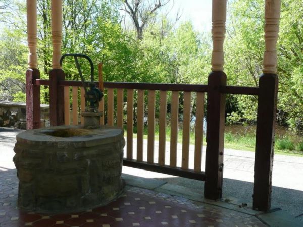
The Kyneton Mineral Springs Rest Area is next to the Campaspe River. There is a small pavillion where you can hand pump some fresh Mineral Water to take with you, and picnic tables, bbq, children's playground next to it. Entrance to the Kyneton Mineral S ...
, , , ,

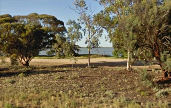
The Lake Boga Rest Area is on the shore of Lake Boga, with plenty of parking and a toilets to make your rest a bit more pleasant. P.S. The lake is sometimes subject to drought condition, so NO WATER. Entrance to the Lake Boga Rest Area Lake Boga Rest ...
, , , ,
The Lake Bolac Rest Area is a short distance to Lake Bolac and water levels in the lake fluctuate, depending on seasonal conditions. Entrance to the Lake Bolac Rest Area Lake Bolac Rest Area location map
The Lake Buninjon Rest Area Take a stroll along the shoreline of the lake, (Water levels do vary a bit) So I'm not sure sure if there are any fish in the lake. Great place to capture birds with your camera. Entrance to the Lake Buninjon Rest Area Lake ...
,
The Lake Charm Rest Area is next to Racecourse Lake and water levels vary according to seasonal conditions. Entrance to the Lake Charm Rest Area Lake Charm Rest Area location map
, , , ,
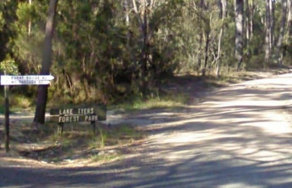
Entrance to the Lake Tyers Forest Park - Toorloo Arm Rest Area Lake Tyers Forest Park - Toorloo Arm Rest Area location map
The Lake Weeroona Park Rest Area has a good playground for the children and you. It's a rather nice place to have a rest. Entrance to the Lake Weeroona Park Rest Area Lake Weeroona Park Rest Area location map
, , , , ,
The Lakes Entrance Parking Area Walk over to the Tidal inlet and toss a line in. Have a BBQ while the kids play on the playground or pop over to the Visitor Information Centre. Entrance to the Lakes Entrance Parking Area Lakes Entrance Parking Area lo ...
, , , ,
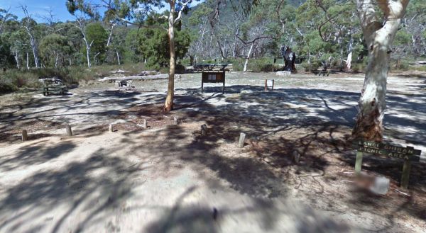
The Langi Ghiran Rest Area is located just on the edge of the State Park, there's a few picnic tables so it's a handy place to pull over to take a break from driving, and it's not to far from Ararat. Entrance to the Langi Ghiran Rest Area Langi Ghiran ...
,
The Leigh River Rest Area is a long gravel road with plenty of spots to choose from and only a short walk over the bridge to the pub for a meal. Entrance to the Leigh River Rest Area Leigh River Rest Area location map
, , ,
Entrance to the Lexton South Rest Area Lexton South Rest Area location map
,
The Lima East Creek Rest Area, is a gravel parking area on the edge of the Midland Highway, with lots of trucks going by. There is a picnic table, a fireplace and a bit of shade. the creek has a trickle of water in it. Entrance to the Lima East Creek Res ...
, ,
Little River Highway Rest Stop (Northbound) now has NO CAMPING signs but it's a nice place to take a break from driving. There is a petrol station next to this rest spot with take away food. Entrance to the Little River Highway Rest Stop (Northbound) ...
The Little River Highway Rest Stop (Southbound) now has NO CAMPING signs but its a nice place to take a break from driving. There is a petrol station next to this rest spot with take away food and an Information Center. Entrance to the Avalon Rest Area ...
The Log Crossing Picnic Area is a large area, with plenty of places to pitch a tent. The pit toilet is located North-West of California Gully, near the Mississippi Creek. Log Crossing Picnic Area Log Crossing Picnic Area location map
, , , ,
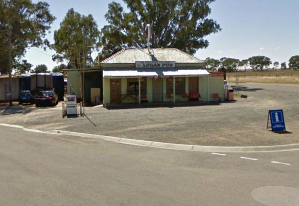
To stay at the Logan Pub Rest Area, please phone ahead, and ask for permission at the pub to camp. ph: (03) 5496 2220 Entrance to the Logan Pub Rest Area Logan Pub Rest Area location map
, ,
Entrance to the Lomond Hill Rest Area Lomond Hill Rest Area location map

Entrance to the Longwarry North Rest Area (Westbound only) Longwarry North Rest Area (Westbound only) location map
, ,
The Malone Park Rest Area has plenty of space for all caravans and motorhomes of all sizes. Entrance to the Malone Park Rest Area Malone Park Rest Area location map
, , ,
The Manangatang Rest Area is a large gravel area set back from Wattle Street with toilets to make a stop here more pleasant. Entrance to the Manangatang Rest Area Manangatang Rest Area location map
, , ,
The Maramingo Creek Rest Area is on the edge of the Princes Highway. You can take a break at one of the picnic tables along this spot. Rubbish bins are also available. Entrance to the Maramingo Creek Rest Area Maramingo Creek Rest Area location map
The McKenzie River Rainforest Walk is approximately a 1 kilometer easy walk (there are a few stairs to negotiate), and is a nice break from driving. The picnic tables, rubbish bins, and toilet facilities make this a nice place to pull over, and as a bonus ...
,
The Meredith Rest Area is a large gravel area with plenty of parking available. There is a toilet block a BBQ, undercover seating and room to stretch your legs. Meredith Rest Area 360 Entrance to the Meredith Rest Area Meredith Rest Area location m ...
, , , ,
The Merrinee North Reset Area is on the edge of the Sturt Highway with plenty of room to park. There are a few trees for shade, and a picnic table and rubbish bin onsite. Entrance to the Merrinee North Reset Area Merrinee North Reset Area location map ...
The Mokoan Rest Area (Northbound) is a busy truck stop and very well appointed, a great place to pull over to take a break from driving with plenty of room to park. Entrance to the Mokoan Rest Area (Northbound) Mokoan Rest Area (Northbound) location m ...
, , ,
The Mokoan Rest Area (South Bound) is a well appointed Truck stop with plenty of room to park. Entrance to the Mokoan Rest Area (Southbound) Mokoan Rest Area (Southbound) location map
, ,
The Moliagul Rest Area has a toilet and bbq plus undercover picnic table, as a side note, John Flynn the founder of the Flying Doctor service was born nearby and they have a monument commemorating this here. Entrance to the Moliagul Rest Area Moliagul ...
, ,
The Mooroopna Rest Area is a nice spot to pull over and have a BBQ it also has a Skateboarding Ramp next to Rest Area to keep the kids busy. Entrance to the Mooroopna Rest Area Mooroopna Rest Area location map
, , , ,
The Mt Korong Scenic Reserve roads can be accessed with normal 2wd vehicles and there are a few hiking trails for the more adventurous to explore. Mt Korong Scenic Reserve location map
The Mt Kosciuszko Lookout Rest Area has a large parking area with wooden benches and tables available for picnics. On a clear day you can see Mt Kosciusko in the distance. Mt Kosciuszko Lookout Rest Area Mt Kosciuszko Lookout Rest Area location map
Mt Sturgeon Rest Area runs alongside the Glenelg Highway, there is plenty of parking space and a picnic table, a few trees and not much else to occupy your time here. Entrance to the Mt Sturgeon Rest Area Mt Sturgeon Rest Area location map
,
Entrance to the Murrayville East Rest Area Murrayville East Rest Area location map
,
The Murrayville Park Rest Area has a public toilet, and picnic tables and there is a Children's Playground and Hotel directly across the road. Entrance to the Murrayville Park Rest Area Murrayville Park R locationmapest Area
, , ,
The Murrungower Rest Area has had a major upgrade with asphalt being laid with plenty of room to park all sized rigs. There is still a toilet block, picnic tables and a few fireplaces available. Entrance to the Murrungower Rest Area Murrungower Rest A ...
,
Myers Flat Rest Area has lots of room to park and plenty of picnic tables and a few fireplaces to cook a meal on, all in a nicely shaded area. Entrance to the Myers Flat Rest Area Myers Flat Rest Area location map
, ,
Nalinga Rest Area is a large gravel area with plenty of parking. There is an undercover picnic tables area with rubbish bins. It's OK for a break from driving and sitting in the shade for a few minutes. The Broken River runs quite close to this rest area, ...
, ,
The Naringal East Rest Area is set back a short distance from the main road. Here you will get a bit of shade from the trees, and a place to rest a bit. Entrance to the Naringal East Rest Area Naringal East Rest Area location map
,
The Native Waterhole Rest Area is set back from the Western Highway, with picnic tables and a few rubbish bins. Entrance to the Native Waterhole Rest Area Native Waterhole Rest Area location map
,
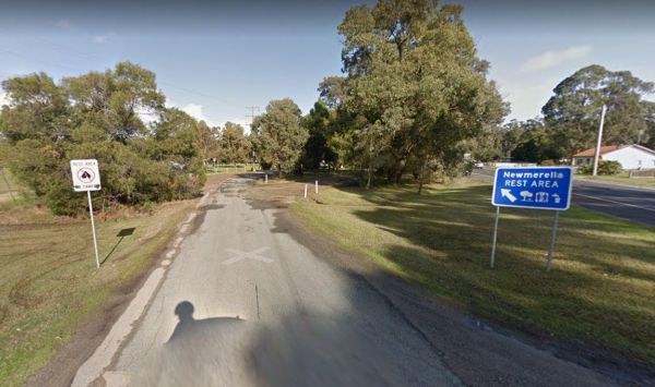
The Newmerella Rest Area is set a short distance back from the Princes Highway, with plenty of parking, Picnic Tables, Fireplaces, Public toilets and water onsite.There is a NO CAMPING Sign displayed at the entrance. Entrance to the Newmerella Rest Area ...
, , , ,
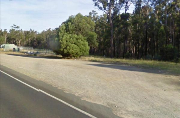
Entrance to the Newmerella Truck Rest Area Newmerella Truck Rest Area location map
,
The Nicholson Rest Area is on the Nicholson River, with toilets and picnic tables for your pleasure, there is also water on tap, and fishing at your doorstep, all in all not a bad place to rest for a few minutes. Entrance to the Nicholson Rest Area Ni ...
, , , , , ,
The Nine Mile Creek Rest Area is set back a short distance from the South Gippsland Highway. There are no facilities here, so not much to do apart from take a rest from driving, and stretch your legs. Entrance to the Nine Mile Creek Rest Area Nine Mil ...
, ,
The Noorinbee Rest Area is a designated power nap area, with picnic tables, public toilets and tap water available. Entrance to the Noorinbee Rest Area Noorinbee Rest Area location map
, ,
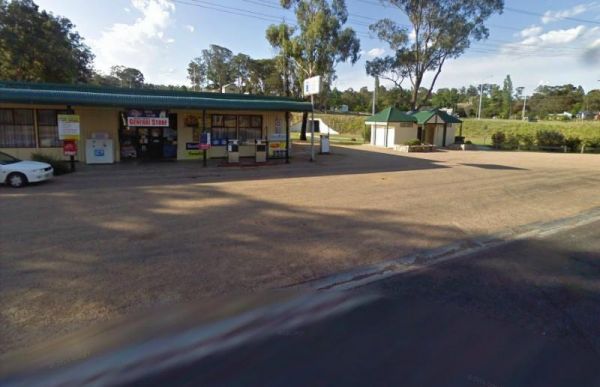
The Nowa Nowa Rest Area is next to the general store, so so can pick up needed food items and fuel up here, then take a few minutes rest, before heading off again on your journey. Entrance to the Nowa Nowa Rest Area Nowa Nowa Rest Area location map
, ,
The Nullawil Rest Area is a very large gravel area wedged between the Calder Highway and the railway line. Pop over to the local Cafe across the road while your here. Entrance to the Nullawil Rest Area Nullawil Rest Area location map
,
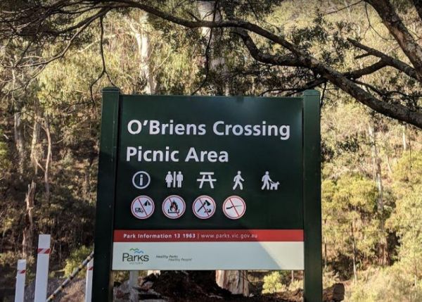
O'Briens Crossing Picnic Area is no allowing camping here, there is another location further up the road but it's a bit on the scary side to drive it. O'Briens Crossing Picnic Area 360 O'Briens Crossing Picnic Area location map
The Ouyen Park has a few picnic tables, and some shade so you can enjoy a break from driving. Entrance to the Ouyen Park Ouyen Park location map
,
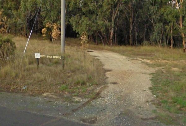
The Perts River Reserve is set well back along a gravel road from the Melba Highway on the Yea River. Nice spot for fishing or photography. Entrance to the Perts River Reserve Perts River Reserve location map
, , ,
The Peterborough Park Rest Area is a lovely day rest area with access to water for those interested in fishing, or photography.Please Note: Peterborough Park is a Rest Area ONLY, No Camping or Overnight Stopovers allowed. There are now signs saying no cam ...
, , , ,
The Peters Bridge Rest Area is a large grassy area next to the Mitta Mitta River. This is a nice rest spot to try your kayak out, and maybe a bit of fishing also. Entrance to the Peters Bridge Rest Area Peters Bridge Rest Area location map
, ,
The Pheasant Creek Flora Reserve has quite a few endangered plants for you to photograph. Entrance to the Pheasant Creek Flora Reserve Pheasant Creek Flora Reserve location map
The Piangil Memorial Park Rest Area The Murray River is not far away if you want to try your hand at fishing. This site has new trees being planted over the last twelve months. So Please Show your Appreciation and leave a donation. Entrance to the Piangi ...
, ,
Entrance to the Piangil North Rest Area Piangil North Rest Area location map
, , ,
The Piangil West Rest Area is set well back from the Mallee Highway, and is a truck stop, so expect some company if you pop in here. Entrance to the Piangil West Rest Area Piangil West Rest Area location map
The Pinasters Picnic Rest Area Runs parallel to the Princes Highway well shaded area. Entrance to the Pinasters Picnic Rest Area Pinasters Picnic Rest Area location map
, ,
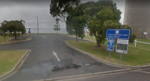
Entrance to the Port Albert Rest Area Port Albert Rest Area location map
, , , ,
The Powelltown Rest Area is a small gravel area with picnic tables and toilets onsite, and not too far from the Little Yarra River, as well as a pleasant walk along the Old Tramways tracks. Entrance to the Powelltown Rest Area Powelltown Rest Area loc ...
, , , ,
At the Ravenswood Rest Area Northbound Truck Stop, you can fill up with fuel, and buy some food, or simply take a break from driving and use the Public Toilets. Entrance to the Ravenswood Rest Area - Northbound Truck Stop Ravenswood Rest Area - Northb ...
, ,
The Reedy Lake Apex Park Rest Area is next to the boat ramp, with lake access so you might be lucky and catch a fish or yabby. Entrance to the Reedy Lake Apex Park Rest Area Reedy Lake Apex Park Rest Area location map
, ,
The Rochester North Rest Area is a gravel area set amongst trees, with Campaspe River running just behind this spot, so you can take a break from driving, have a picnic, or try to catch dinner at the same time. Entrance to the Rochester North Rest Area ...
, , ,
Entrance to the Rosedale Vicroads Wayside Stop Rosedale Vicroads Wayside Stop location map
, , ,
The Rutherglen East Rest Area is a shady area, set between the Murray Valley Highway and Doolans Road with plenty of room for large rigs. Entrance to the Rutherglen East Rest Area Rutherglen East Rest Area location map
,
The Ryan Creek Rest Area has an information bay, a BBQ and picnic tables, so it's not a bad place to pull over for a few minutes, take a break and watch the traffic go by. Entrance to the Ryan Creek Rest Area Ryan Creek Rest Area location map
, ,
The Sandbanks Reserve is a large rest area on the banks of the LaTrobe River, you can try your luck at fishing here, or recover from driving for a few hours. NOTE: NO CAMPING ALLOWED Entrance to the Sandbanks Reserve Sandbanks Reserve location map
The Sarsfield Rest Area has large grassy area on the banks of the Nicholson River, time to go fishing or test out the Kayak again. Entrance to the Sarsfield Rest Area Sarsfield Rest Area location map
, , ,
The Scarsdale Rest Area is set back from the main road and is a fairly large gravel area, that can handle all sized vans, and motorhomes. There is a picnic table and nearby rubbish bin also at this spot. Entrance to the Scarsdale Rest Area Scarsdale R ...
The Sea Lake North Rest Area is on the corner of Calder Highway and Baileys Road. It's about 1km from the Lake Tyrrell Viewing platform, and worth the extra time to take a few photos from there. Entrance to the Sea Lake North Rest Area Sea Lake North ...
,
The Sheepwash Lagoon Rest Area has a few picnic tables and rubbish bins, set next o the lagoon which might have a few yabbies or eels in it, who knows, maybe try your luck, and let us know about your results, Entrance to the Sheepwash Lagoon Rest Area ...
,
The Sherwoods Dam Rest Area has a warning sign near the water. Algae blooming is common in this area, which will make the water toxic to drink. Entrance to the Sherwoods Dam Rest Area Sherwoods Dam Rest Area location map
The Silver Gum Reserve Rest Area is set back from the Maroondah Highway and is a place to take a break from driving. Entrance to the Silver Gum Reserve Rest Area https://goo.gl/maps/UKdLSLkMD1YM5Yae8 Silver Gum Reserve Rest Area location map
The Skinners Flat Rest Area Great camping spot. Very basic amenities (drop toilet), fairly quiet - some road noise from the highway, but not too bad. Can get large vans in easily. Skinners Flat Rest Area 360 Skinners Flat Rest Area location map
, ,
Entrance to the Snowy River Rest Area No 1 is just off Marlo Road with a large grassy area to park on, and the Snowy River on your doorstep. So pull out your fishing rod and good luck. Entrance to the Snowy River Rest Area No 1 Snowy River Rest Area N ...
, , ,
The Snowy River Rest Area No 2 is another large grassy area situated on the banks of the Snowy River. There is a picnic table located here as well. Entrance to the Snowy River Rest Area No 2 Snowy River Rest Area No 2 location map
, , ,
The Staghorn Flat Rest Area is on the verge of the main road. if you stop here be sure to checkout the stone monument while your there. I'm curious as to what it is dedicated to. If anyone knows please pop a message to admin. Entrance to the Staghorn Fla ...
,
The Stan Allen Reserve Rest Area has a 20 hour stop over limit has some nice shady spots to choose from along the bank of the King River. Public Toilets are on the Oxley side of the bridge, and that is only a short walk from the rest area. Entrance to th ...
, , ,
The Stanhope East Rest Area is located on the corner of Midland Highway and Savige Road, it's just a place to pull over and recover from driving. Entrance to the Stanhope East Rest Area Stanhope East Rest Area location map
,
The Stawell Federation Park Rest Area is a large gravel area with water taps and fireplaces and picnic tables., you can also walk over the Grampians Rd and enjoy a short walk around the small lake, There are also public toilets and an information board at ...
, , ,
The Stuart Mill South Rest Area is on the edge of the Sunraysia Highway, this rest spot has a couple of rubbish bins and that's it. You can sit in you vehicle or van and watch the traffic go by. Entrance to the Stuart Mill South Rest Area Stuart Mill ...
The Swan Reach Rest Area is directly opposite the Swan Reach General Store, so you can pop over and purchase a few essentials for your journey while stopping here. Entrance to the Swan Reach Rest Area Swan Reach Rest Area location map
, ,
The Tallandoon Rest Area is on the banks of the Mitta Mitta River, so water activities area available here along with some nice photography options.NOTE: There is a 24 hour limit for staying here. Entrance to the Tallandoon Rest Area Tallandoon Rest A ...
, , ,
The Tallangatta Creek Rest Area is a gravel area with a picnic table closer to the creek, it's not a bad place to take a break from driving. Entrance to the Tallangatta Creek Rest Area Tallangatta Creek Rest Area location map
, , ,
The Tambo River Swan Reach Rest Area is next to the Princes Highway Tambo River bridge. So it's a handy stop where you can sit on the river bank and catch a bream or two. Entrance to the Tambo River Swan Reach Rest Area Tambo River Swan Reach Rest Are ...
, ,
The Tamboon Rest Area - East of Cann River Entrance to the Tamboon Rest Area - East of Cann River Tamboon Rest Area - East of Cann River location map
The Tanwood South Rest Area is just off the Sunraysia Highway, with rubbish bin and picnic tables. Why not grab a bite to eat, while you watch the traffic go by. Entrance to the Tanwood South Rest Area Tanwood South Rest Area location map
,
The Tarra River Rest Area is a handy spot on the South Gippsland Highway, here you can stretch your legs, and maybe grab a bite to eat before continuing your journey. Entrance to the Tarra River Rest Area Tarra River Rest Area local map
, , ,
The Taungurung Truck Stop Rest Area (Southbound Only) if you decide to stay overnight, make sure you don't block the semi trailer drivers, who need this spot more than you. Entrance to the Taungurung Truck Stop Rest Area (Southbound Only) Taungurung T ...
, , ,
The Teddywaddy Rest Area is a gravel area with a fireplace, picnic table and rubbish bin. Entrance to the Teddywaddy Rest Area Teddywaddy Rest Area location map
The Walnuts Campground is a nice grassy area with fireplaces and picnic tables next to the Snowy Creek. Overnight camps are permitted here, and it's a wonderful place for photography and maybe catch a fish for dinner. Entrance to the Walnuts Campground ...
, , ,
The Thurra River Rest Area has water on tap, but please treat it first before drinking, there are also picnic tables and a few BBQ's, there is also has a nice walk along the Drummer Creek, remember to take your camera with you. Entrance to the Thurra Riv ...
, ,
The Tolmie Rest Area has a toilet and a picnic table and overnight Camping is permitted here, there is a pub approx 100 metres from this rest spot. Entrance to Tolmie Rest Area Tolmie Rest Area location map
, , , ,
The Tongala Turnoff Rest Area is not far from Henderson Road, here you will find a wood fired BBQ, a picnic table and a rubbish bin, all set a short distance from the Murray Valley Highway. Entrance to the Tongala Turnoff Rest Area Tongala Turnoff Res ...
, ,
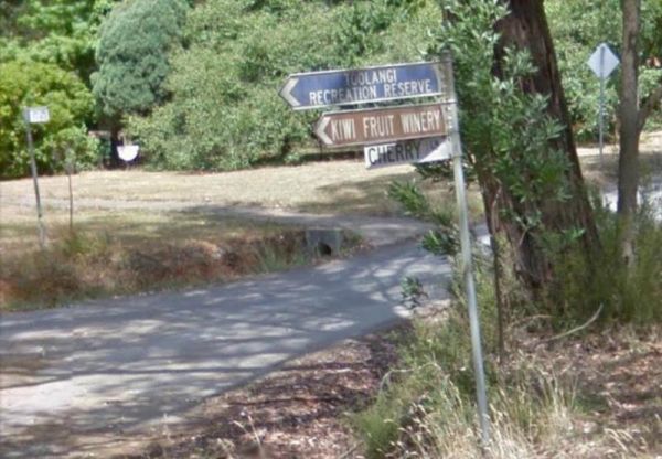
The Toolangi Streamside Reserve is fairly close to the Yea River, and there is a 24 hour stopover limit. There are toilets and rubbish bins here to make your visit pleasant. Toolangi Streamside Reserve location map
, ,
The Tooleybuc Park has a large gravel area to park your van or motorhome, and its close to the Tooleybuc bridge over the Murray River, and conveniently located across the road from a pub, so you can grab a meal while stopping here. Entrance to the Tooley ...
, , , ,
The Tooradin Foreshore Reserve is now a very active boat launching spot, the victorian government has removed boat launching fees for this location, and as such, parking is at a premium Entrance to the Tooradin foreshore camping Tooradin foreshore cam ...
, , , , ,
The Torneys Tank Bushland Reserve Rest Area is set back on gravel road just off the Calder Highway, with picnic tables and rubbish bins. Take a break from driving and grab a bite to eat. There is plenty of room for even the largest of rigs. Entrance to t ...
, , ,
The Torquay Taylor Park Rest Area is a nice location next to the Ocean, Entrance to the Torquay Taylor Park Rest Area Torquay Taylor Park Rest Area location map
, , , ,
The Traralgon Rest Area (West) Entrance to the Traralgon Rest Area (West) Traralgon Rest Area (West) location map
,
The Trawalla State Forest Rest Area is on the verge of the Western Highway. There is plenty of room to park your caravan or motorhome. Also a couple of rubbish bins and picnic table, pus a fer walking tracks into the State Forest. Entrance to the Trawall ...
,
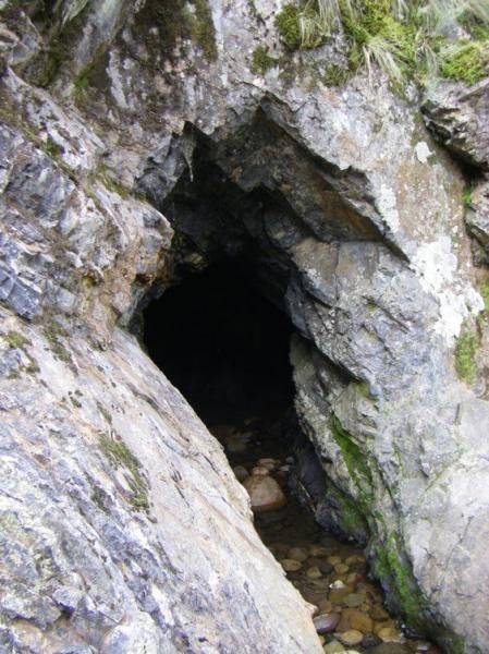
The Tunnel Bend Camping Area is located on the Howqua River. Checkout the surrounding hills for signs of the early gold mining activities such as the tunnel in the photos which diverted water so the Old timers could mine for gold. Tunnel Bend Camping Are ...
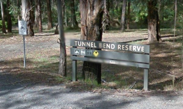
The Tunnel Bend Reserve Camping Area has toilets and plenty of choices to camp. There are also fire pits at this campsite which is located on the banks of the Upper Goulburn River. Entrance to the Tunnel Bend Reserve Camping Area Tunnel Bend Reserve C ...
The Underbool Park has plenty of room to park, public toilets and undercover bbq and picnic tables. There is also a public phone booth and a pub within walking distance. Entrance to the Underbool Park Underbool Park location map
, , ,
The Victoria - South Australia Border Rest Area is a very large area, with plenty of shade and picnic tables. There are quite a few rubbish bins, an undercover picnic table, and a toilet block with wheelchair facilities. Entrance to the Victoria - South ...
, , ,
The Victory Park is located opposite the main Shopping strip. Great place to stop, grab a bite to eat, or stock up on food for your trip. Entrance to the Victory Park Victory Park location map
, , ,
The Walpeup Rest Area is a gravel area has undercover picnic tables, and a few rubbish bins and a BBQ's. Entrance to the Walpeup Rest Area Walpeup Rest Area location map
, ,
The Warburton East Rest Area is a long gravel road next to the Yarra River. You can try fishing, or simply go for a short walk to stretch your legs with your camera in hand. Entrance to the Warburton East Rest Area Warburton East Rest Area location ma ...
, , ,
The Wedderburn West Rest Area is not the safest of places if you have young children or pets with you. Its located on the narrow verge of the road. Entrance to the Wedderburn West Rest Area Wedderburn West Rest Area location map
,
The Wharparilla Flora Reserve Rest Area Entrance to the Wharparilla Flora Reserve Rest Area Wharparilla Flora Reserve Rest Area location map
,
The Winchelsea Park Rest Area runs along the Barwon river, with lots of places to camp. There are public toilets and picnic tables at the Willis Street end. Entrance to the Winchelsea Park Rest Area Winchelsea Park Rest Area location map
The Won Wron North Rest Area is set back a short distance from the Hyland Highway, it's a reasonably quiet stopover for a picnic. Entrance to the Won Wron North Rest Area Won Wron North Rest Area location map
,
The Wood Wood Rest Area has NO CAMPING signs, so remember this if you intend to stop for an hour or two. It's also a bit on the tight side if your towing a van. Entrance to the Wood Wood Rest Area Wood Wood Rest Area location map
The Wycheproof North Rest Area 1 is just a place to pull over if your feeling tired, then on your way again. Entrance to the Wycheproof North Rest Area 1 Wycheproof North Rest Area 1 location map
The Wycheproof North Rest Area 2 is a gravel section just off the Calder Highway has a few trees offering limited shade and a rubbish bin. Entrance to the Wycheproof North Rest Area 2 Wycheproof North Rest Area 2 location map
The Wycheproof South Rest Area Entrance to the Wycheproof South Rest Area Wycheproof South Rest Area location map
,
The Wyuna Rest Area is not far from McCoys Bridge which spans the Goulburn River. So if your up for a short walk you could try fishing, or grab your camera and take a few photos. Entrance to the Wyuna Rest Area Wyuna Rest Area location map
The Yackandandah Lake Picnic Reserve is on the edge of the Allans Flat Waterhole, so there is a good chance you can catch a fish for dinner here, or maybe take a plunge and go for a swim instead.This artificial lake was created by Gold miners in the 1850s ...
The Yackandandah North Rest Area Entrance to the Yackandandah North Rest Area Yackandandah North Rest Area location map
The Yallock Creek Rest Area has room to park your van, an undercover picnic table and a few BBQ's to help take the stress out of driving. Entrance to the Yallock Creek Rest Area Yallock Creek Rest Area location map
,
The Lance Moon Park is close to the Yanakie General Store, so you can grab a few supplies, and have a BBQ before you head off to your destination. Entrance to the Lance Moon Park Lance Moon Park location map
, , ,
The Yuppeckiar Park Rest Area is a short distance from the Glenelg Highway, Be careful if you decide to park on the grass area, as there is a ditch sometimes hidden and you will get bogged there if towing a caravan. Entrance to the Yuppeckiar Park Rest A ...
, , ,