Free Camping: Recently Updated Listings
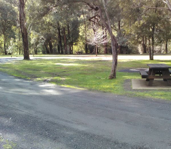
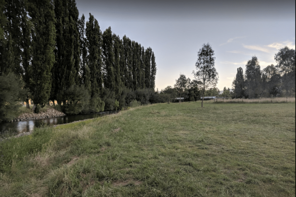
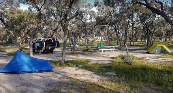
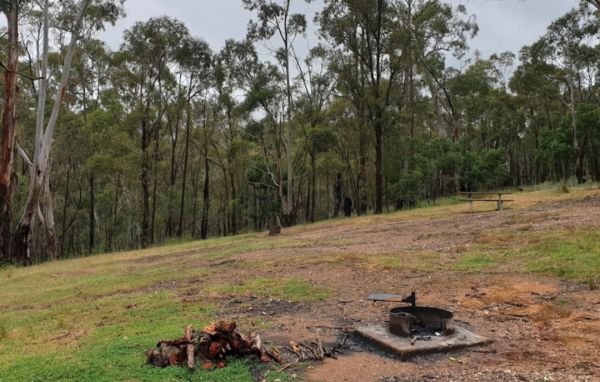
This free campground boasts a pleasant environment, featuring numerous level and grassy camping spots, some equipped with its own fire pit, bring your firewood, and a couple of picnic tables are available for your convenience. There are numerous well-kept ...
 ,
,  ,
,  ,
,  ,
, 
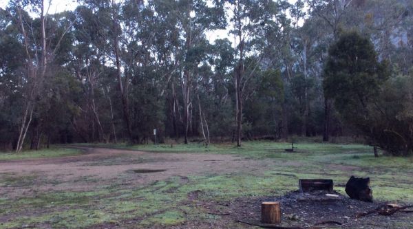
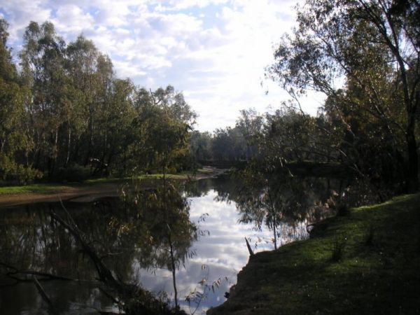
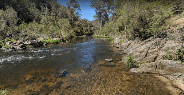
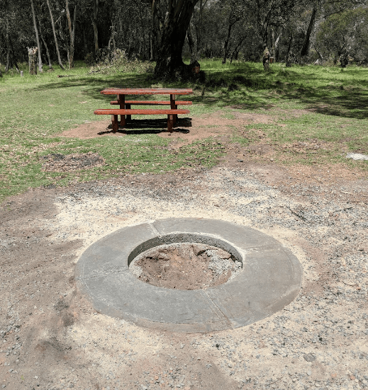
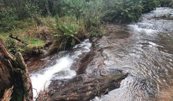
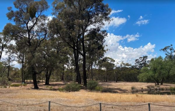
This free camping site can be found a brief drive down an unpaved road, offering a prime riverside location. The campgrounds may get muddy after rain, which could be problematic during wet weather. Some sites have multiple fire pits. It's recommended to b ...
, ,  ,
,
THIS CAMPSITE is now PERMANENTLY CLOSED due to inconsiderate campers damaging the property. The Lumbys Bend Camping Area With the Murray River meandering by, water activities including fishing,swimming, kayaking etc. come to mind and photography all av ...

The Toorongo Falls Campground 1 has toilets, fireplaces, and plenty of room to choose a campsite alongside the Toorongo River. Firewood can be obtained from the Noojee General Store Toorongo Falls Campground 1 location map
,  , ,
, ,
The Pines Campground is a very basic campsite located next to the Big River, you will need to bring everything you need with you, and take your rubbish when you leave. The Pines Campground location map
, ,
Mount Beckworth Scenic Reserve - Manna Gums - Camping Area location map
,
The Morwell River Free Camping site 1 is on the banks of the Morwell River, please take your rubbish with you when leaving. Morwell River Free Camping site 1 location map
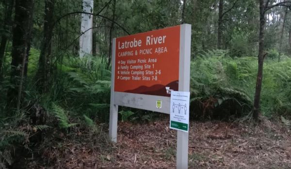
The Latrobe River Camping Area is a quiet campsite surrounded by beautiful bushland, drop toilets and pit fires are provided. The camping ground is fairly close to where the La Trobe River and Ada River join. Latrobe River Camping Area location map
The Indi Bridge Reserve Camping Area has a sign at the gate that points out that a diesel pump can start and run at any time, so maybe give it a bit of distance to where you camp. Indi Bridge Reserve Camping Area location map
The Horseyard Flat Camping Area Located on the Moroka River remember to keep the place tidy for the next visitors. Horseyard Flat Camping Area location map
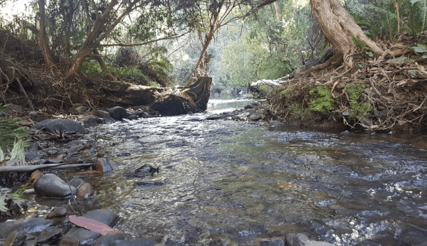
The Frenchmans Creek Camping Area is next to the Big River, and the campsites are better suited to vehicle based camping rather than caravans. I'd recommend a 4x4 incase it rains. Frenchmans Creek Camping Area location map

The Cobrawonga Island Camping Area is on the Banks of the Murray River, with a few shaded campsites available. Toilets are onsite, no rubbish bins, and plenty of opportunities to catch a fish dinner. Cobrawonga Island Camping Area location map
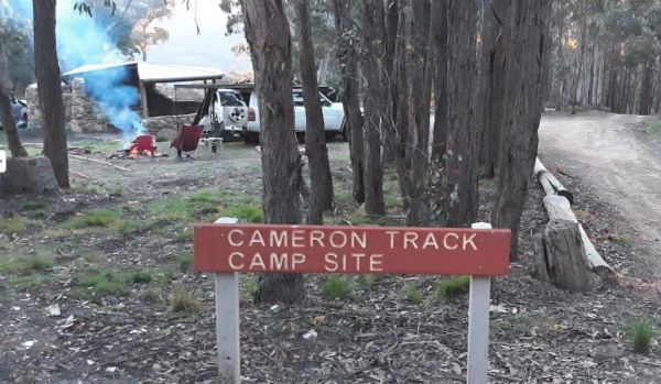
The Cameron Track Camping Area is fairly remote, so its best to bring everything you need, and be prepared to take your rubbish with you when you leave. Cameron Track Camping Area location map
, , 
The Buttercup Creek Camping Area has 5 separate Campgrounds in total. The camping areas available range fro 2 to 20 separate camps at each location. You will be able use you 4x4 around your base camp, or enjoy some bush walking along the numerous tracks f ...
The Western Beach Camping Area has excellent toilets with lighting and tank water on tap. Western Beach Camping Area location map
, , ,
The Walpeup Lake Camping Area Walpeup Lake Camping Area location map
,
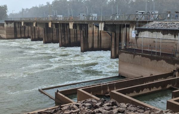
The Torrumbarry Weir Camping Area is a rough bush camp with plenty of spots to choose from close the Murray River. Be sure to pop over to the Weir gates and take your camera with you for a good photographic opportunity. Entrance to the Torrumbarry Weir C ...
The Surface Point Camping Area Surface Point Camping Area location map
, , 
The Shadbolts Picnic Area is between Eaglehawk-Neilborough Road and Skylark Road and close to the Raywood Channel. There is not a lot to do here, however there are a few areas, to walk to and explore for the more adventurous out there. Entrance to Shadbo ...
,
The Samaria Wells Camping Area is a best suited to tent based camping with plenty of walking tracks to explore.. Samaria Wells Camping Area location map
,