Facilities: Pet Friendly
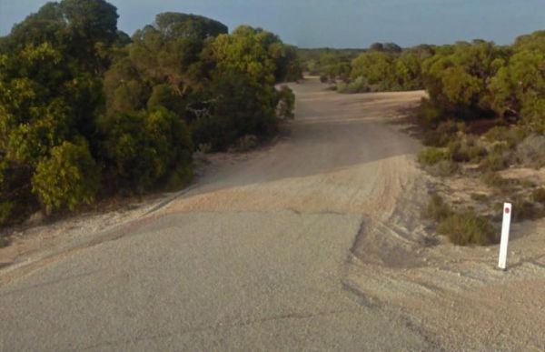
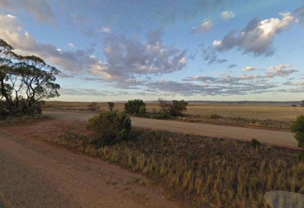
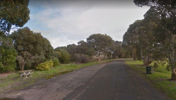
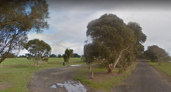
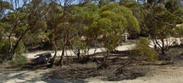
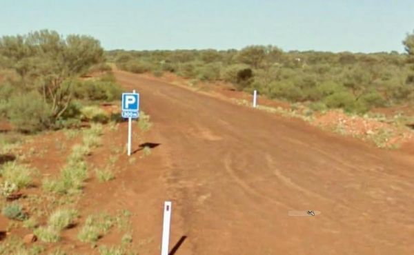
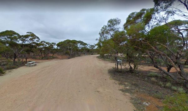
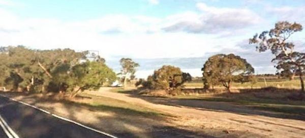
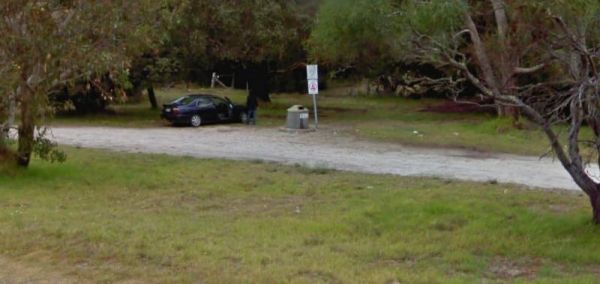
The 10k Peg Rest Area has plenty of spots to choose an overnight stay, plus a few tracks into the bush, for the more adventurous. Entrance to the 10k Peg Rest Area 10k Peg Rest Area location map

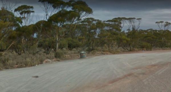
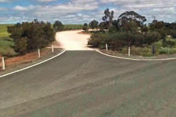
The 12 Mile Dam Rest Area is just on the edge of the Eyre Highway, with a few trees offering limited shade. There are also a rubbish bin here, the track to the dams has been blocked.. Entrance to the 12 Mile Dam Rest Area 12 Mile Dam Rest Area locatio ...
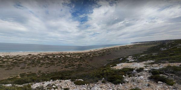
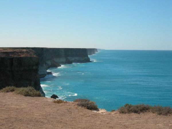
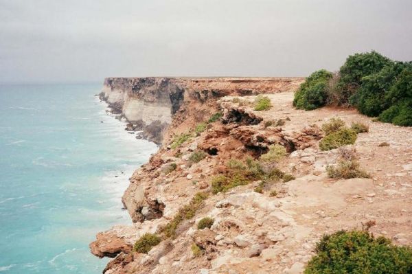
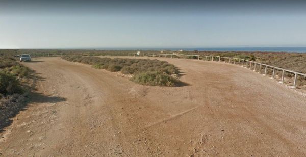
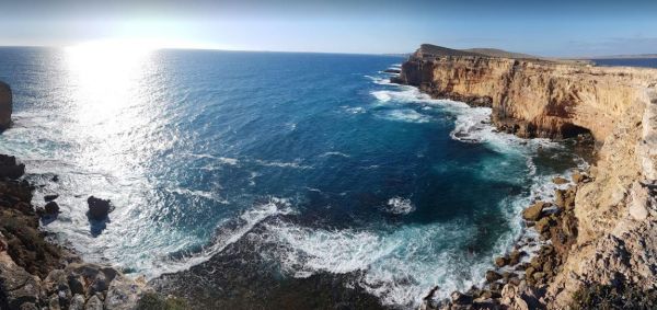
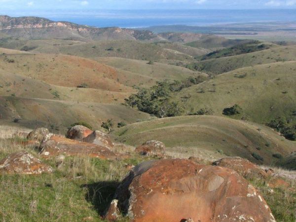
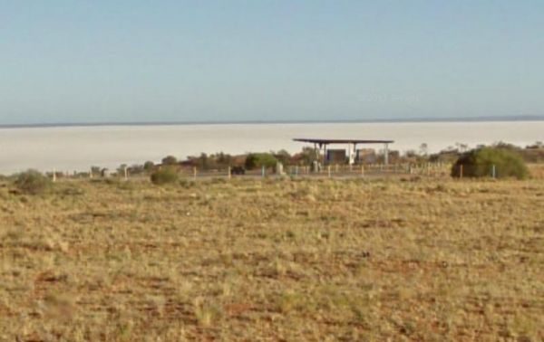
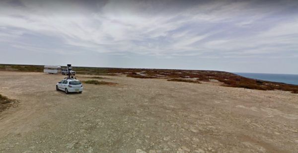
The 13k Peg Scenic Lookout is just off the Eyre Highway, and close to the Great Australian Bight, so you will be able to get some amazing photo records of this place, so you will remember for years to come. Entrance to the 13k Peg Scenic Lookout 13k P ...
Entrance to the 157k Peg Rest Area 157k Peg Rest Area Location Map
Entrance to the 164k Peg Rest Area 164k Peg Rest Area location map
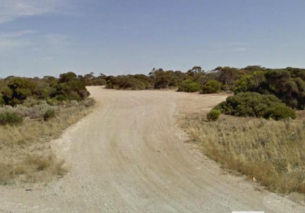
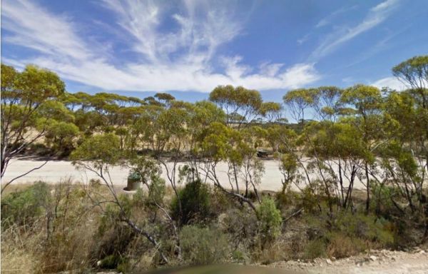
The 17k Peg Rest Area is set back a short distance on a gravel area with ocean views, it is a fair walk to the water's edge, but there are walking tracks for those who want to explore a bit more than the average person. Entrance to the 17k Peg Rest Area ...
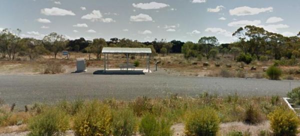
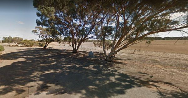
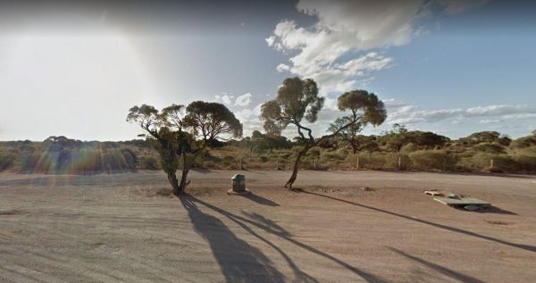
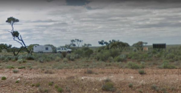
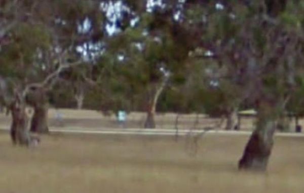
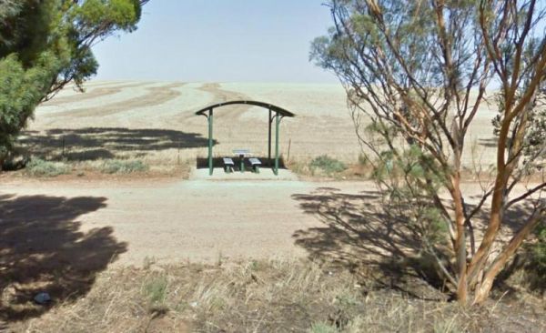
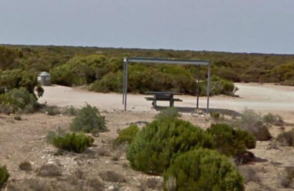
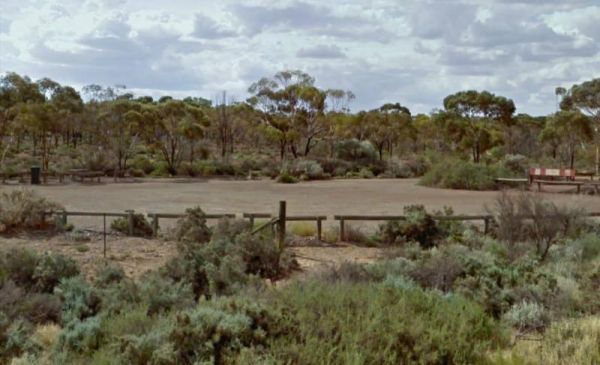
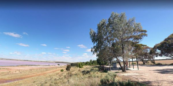
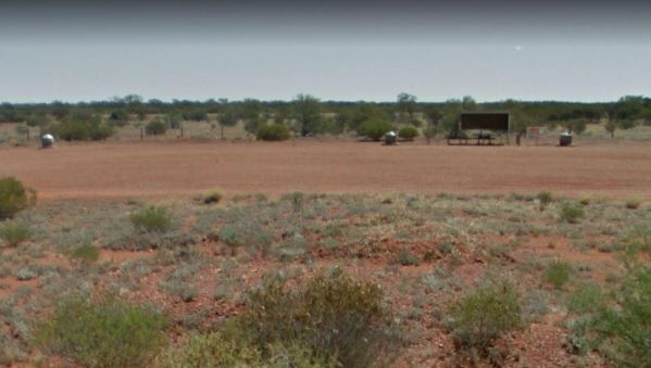
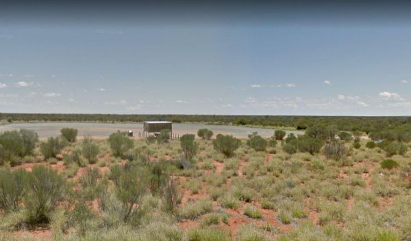
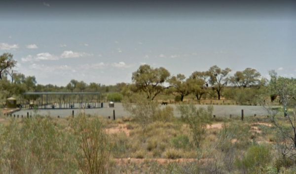
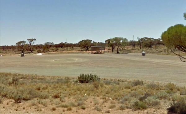
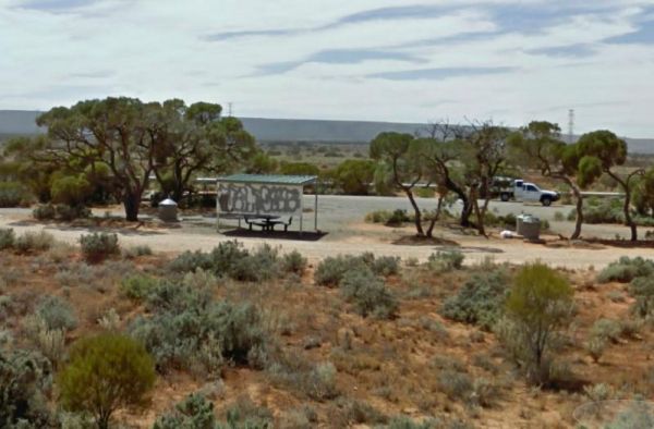
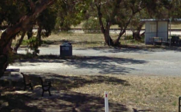
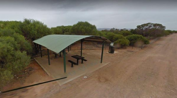
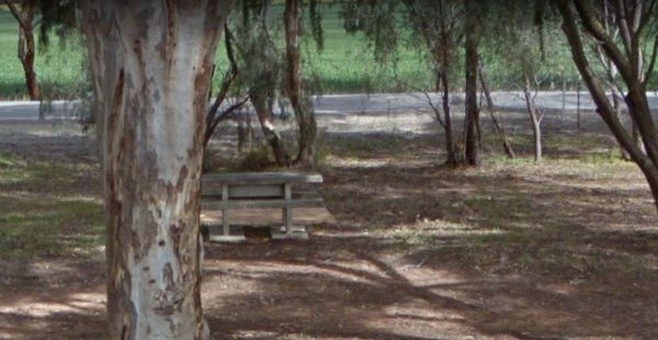
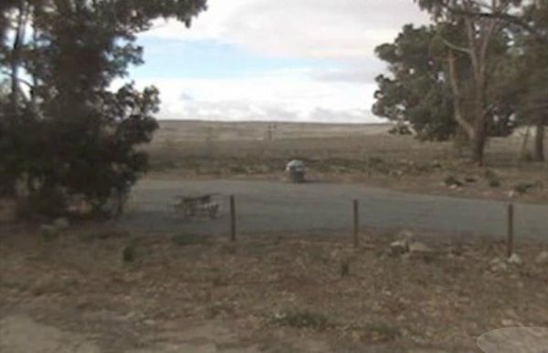
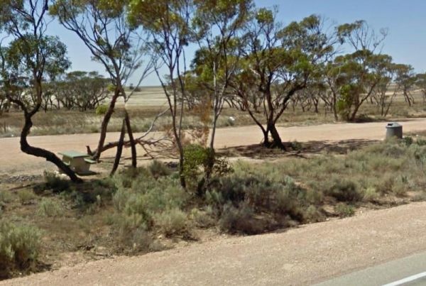
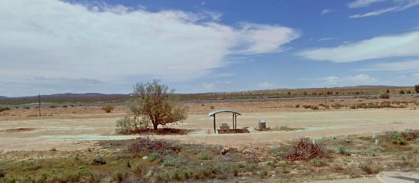
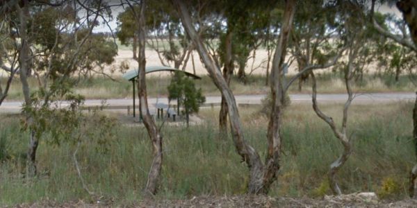
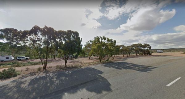
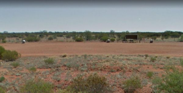
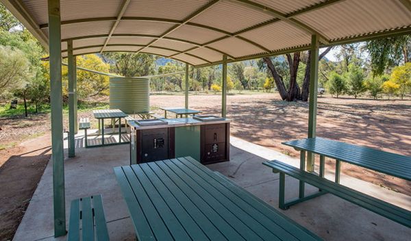
The 21k Peg Rest Area is set back from the Goyder Highway. There is an undercover picnic table with rubbish bin, and a little bit of shade for your van. This is a fairly level campground with quite a bit of room for the larger rigs, and motorhomes. Entra ...
The 222k Peg Rest Area is just off the Eyre Highway with level dirt areas, wich give a few choices for parking your rig and finding some relief from the sun. Entrance to the 222k Peg Rest Area 222k Peg Rest Area location map
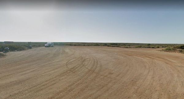
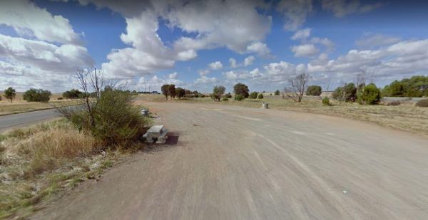
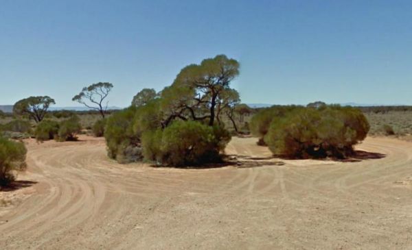
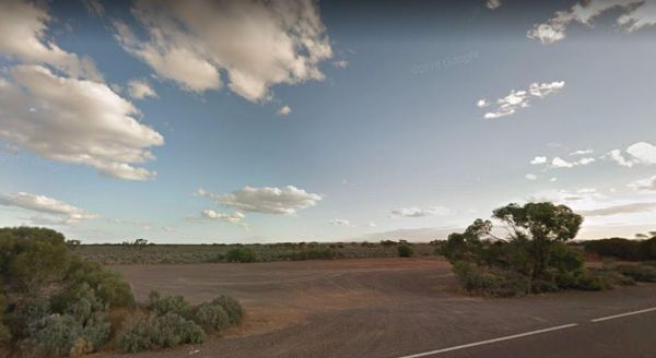
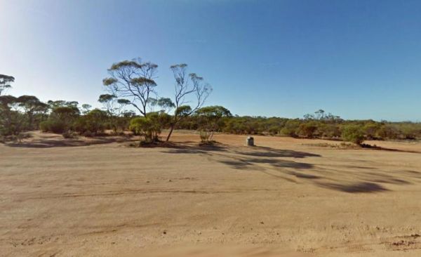
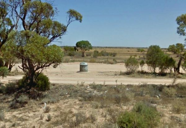
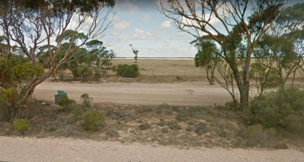
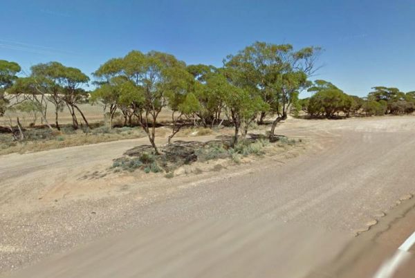
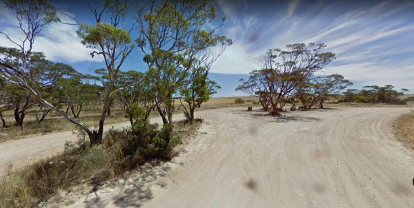
The 25k Peg Rest Area is just off the Eyre Highway and is a large open area with level spots available. Here you will have a magnificent view of the Ocean, plus there are a few walking tracks. But don't get too adventurous, one slip, and your history. En ...
The 38k Peg Rest Area Level area and just a short walk to the Cliffs overlooking the Ocean Grab your camera. Entrance to the 38k Peg Rest Area 38k Peg Rest Area location map
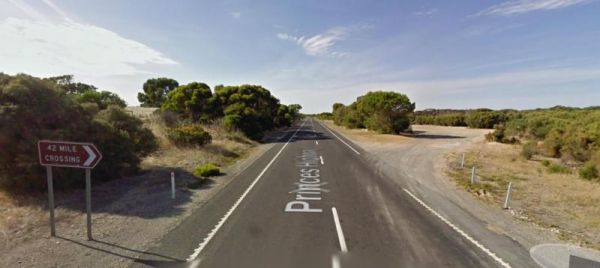
The 42 Mile Crossing Rest Area is a large gravel area set back from the Princes Highway. There is plenty of room to park any sized rig and a few small trees that separate you from the Princes Highway. Entrance to the 42 Mile Crossing Rest Area 42 Mile ...
The 42k Peg Scenic Lookout is a short drive off the Eyre Highway with a Beautiful view of the Great Australian Bight, The parking area is gravel with no amenities, but you can let your pet have a run if you like. Entrance to the 42k Peg Scenic Lookout ...
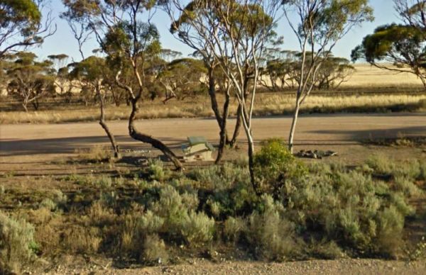
The 52k Peg Rest Area is a level gravel area set back a short distance from the Eyre Highway which has an emergency water supply. There is another track leading to the cliffs which has Ocean views. Entrance to the 52k Peg Rest Area 52k Peg Rest Area l ...
, 
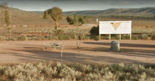
The 75k Peg Scenic Lookout is approx 1 Kilometre to the Scenic Rest Area from the Eyre Highway, It consists of a gravel area and a short walk to the cliffs for a good photography opportunity. Entrance to the 75k Peg Scenic Lookout 75k Peg Scenic Looko ...
The Agnes Creek Rest Area is set back a few hundred metres on a gravel surface from the Stuart Highway. There is a picnic table a few rubbish bins and that's about it. Entrance to the Agnes Creek Rest Area Agnes Creek Rest Area location map
 ,
,

The Ambrosia Rest Area has plenty of room for semi trailers and caravans alike. There are public toilets, and rubbish bins, and plenty of shade to be had by all. Entrance to the Ambrosia Rest Area Ambrosia Rest Area location map
 ,
,

The Baan Hill Reserve Picnic Area has rainwater tanks, toilets and a covered picnic table. This is a popular spot for the 4x4 enthusiasts, and it's not far from the Ngarkat Conservation Park HIstoric site. Baan Hill Reserve Picnic Area location map ...
,  , , ,
, , ,
The Barkers Rocks Camping Area is nestled has an undercover picnic table and an emergency supply of water. There are a few areas to park your caravan. Entrance to the Barkers Rocks Camping Area Barkers Rocks Camping Area location map
 , ,
, ,
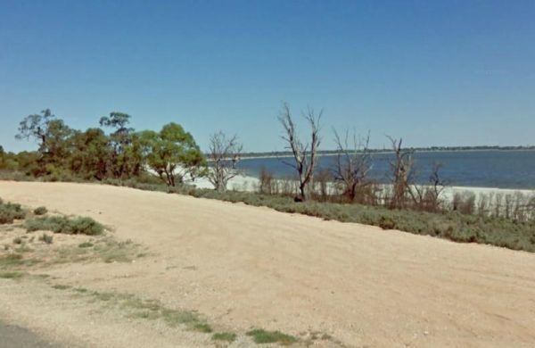
The Barmera Apex Park Rest Area is a gravel area within easy walking distance to the Lake Bonney. The lake is quite shallow here, so it's not a bad spot to have a splash with the kids. Entrance to the Barmera Apex Park Rest Area Barmera Apex Park Rest ...
, , , ,  ,
,
The Black Rock South Rest Area is a level site running a few metres and parallel to the Orroroo-Peterborough Road, there is no sound buffer from the passing traffic noise. Entrance to the Black Rock South Rest Area Black Rock South Rest Area location ...
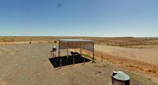
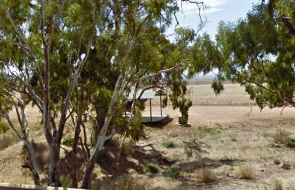
The Bon Bon Rest Area is on a large gravel area set back from the Stuart Highway. You will find a public telephone, toilets, an undercover picnic table, a few rubbish bins and an emergency supply of drinking water, as with all tank water, its best to boil ...
, ,
The Bookaloo Rest Area is a level area to park with an undercover picnic table and lots of flat empty nothingness to look at while there. Entrance to the Bookaloo Rest Area Bookaloo Rest Area location map
The Bool Lagoon Turnoff Rest Area is just a short distance off the Riddoch Highway. There are picnic tables, a bit of shade and an information wall and an undercover picnic table, and rubbish bins. Entrance to the Bool Lagoon Turnoff Rest Area Bool La ...
,
The Boston Bay Rest Area is a large gravel area with public toilets and aa undercover picnic tables overlooking the sea. The Lions Picnic Spot is next door. Entrance to the Boston Bay Rest Area Boston Bay Rest Area location map
, ,
The Brachina Creek Rest Area is back a short distance to The Outback Highway. Don't expect to catch any fish here as the Brachina Creek is a seasonal creek, dependant on rainfall. Entrance to the Brachina Creek Rest Area Brachina Creek Rest Area locat ...
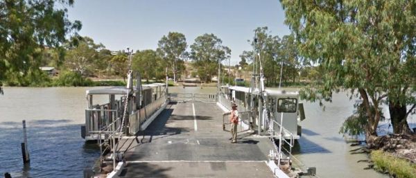
The Caurnamont Reserve Rest Area is next to the the Murray River, with Public Toilets and room to park your caravan. From here you can take the ferry across to Purnong Landing. Entrance to the Caurnamont Reserve Rest Area Caurnamont Reserve Rest Area ...
, ,
The Chandada Pioneer Park Runs alongside the Streaky Bay Highway, its a level area with Rubbish bins and a picnic table, and a few farming relics, but very limited shade. its OK for a break from driving. Entrance to the Chandada Pioneer Park Chandada ...
,
The Clay Wells Rest Area runs parallel to the Princes Highway, there is a picnic table and rubbish bins, some shady trees, with not a lot between you and the Princes Highway. Entrance to the Clay Wells Rest Area Clay Wells Rest Area location map
,
The Cohen Rest Area has easy access for all sized rigs, there are some rubbish bins and lots of shady spots. If you stay overnight you will hear some traffic noise as truck pass by. Entrance to the Cohen Rest Area Cohen Rest Area location map
, ,
The Colona Rest Area is a level gravel area just off the the Eyre Highway, with a bit of shade, picnic table and rubbish bin. There is plenty of room to park your caravan. Entrance to the Colona Rest Area Colona Rest Area location map
The Coomandook North Rest Area is a gravel area just off the Dukes Highway. A rubbish bin and picnic table along with limited shade. This is a place to stop when you really need a few minutes rest from driving, then on your way again. Entrance to the Co ...
The Coomandook Park Rest Area has plenty of room to park all sized rigs. There are undercover picnic tables, Rubbish bins and a public toilet. You can also walk across the road to the Coomandook General store and stock up on a few items or fill your fuel ...
, ,
The Coonawarra Rest Area is just off the Riddoch Highway on a gravel road with plenty of room to park your caravan. There are rubbish bins and an undercover picnic table overlooking vineyards. Entrance to the Coonawarra Rest Area Coonawarra Rest Area ...
,
The Cootra Rest Area is a gravel area just off the Eyre Highway. There is room for your caravan, while you sit in the undercover picnic table, and a rubbish bin is here also. Entrance to the Cootra Rest Area Cootra Rest Area location map
The Culburra North Rest Area Entrance to the Culburra North Rest Area Culburra North Rest Area location map
,
The Cummings Lookout Rest Area is just off the Flinders Highway. It's a further 500 metres to the Cummings Monument, which overlooks the Great Australian Bight. Entrance to the Cummings Lookout Rest Area Cummings Lookout Rest Area location map
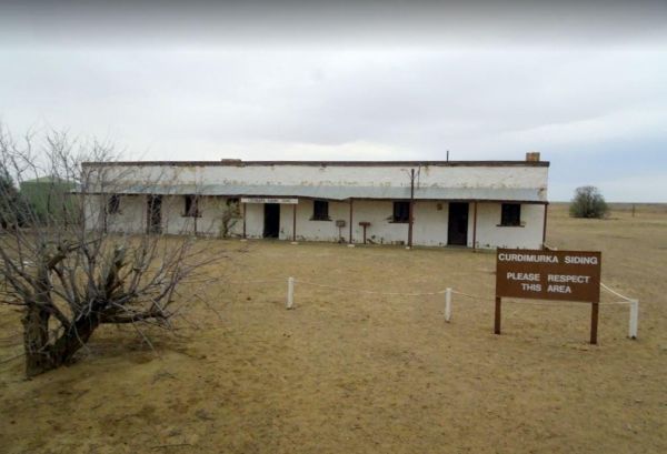
The Curdimurka Siding Rest Area is not far from the Oodnadatta Track. This "Old Ghan" passenger train used to run passed here up until 1980. It has now been superseded with "all weather" rail route between Tarcoola and Alice Springs. Curdimurka Siding Re ...
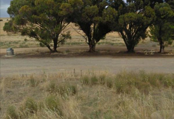
The Cutana Rest Area has picnic tables on both sides of the Barrier Highway, and also rubbish bins. It's a fairly level area and can easily take all sized rigs. Entrance to the Cutana Rest Area Cutana Rest Area location map
The Darkes Memorial Rest Area is set back a short distance on a gravel surface from the Eyre Highway. There are rubbish bins, some small shady trees, and plenty of parking areas that are relatively flat. Entrance to the Darkes Memorial Rest Area Darke ...
The Drain M Rest Area is set back from the Princes Highway with a small row of trees for shade, and a rubbish bin. There's not much to do here apart from taking a break from driving. Entrance to the Drain M Rest Area Drain M Rest Area location map ...
,
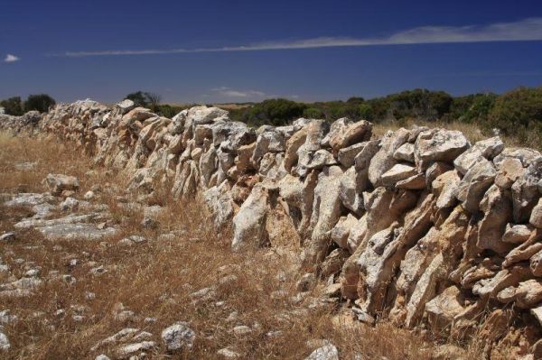
The Dry Stone Walling Rest Area is close to Lake Tunketta, and next to a long dry stone wall. There are a few small trees separating this rest area and the Princes Highway. Entrance to the Dry Stone Walling Rest Area Dry Stone Walling Rest Area locati ...
The Dublin Lions Park Rest Area Entrance to the Dublin Lions Park Rest Area Dublin Lions Park Rest Area location map
, ,  , ,
, ,
The Dublin North Rest Area is in close proximity of the Princes Highway with an undercover picnic table, and a few rubbish bins. There is very limited shade here, but plenty of room to park your caravan. Entrance to the Dublin North Rest Area Dublin N ...
,
The Eight Mile Corner Rest Area is set back a short distance from the Sturt Highway, with plenty of room to park. There is an undercover picnic table nad rubbish bin at your disposal here but not much else.There is a 20 hour stopover permitted at this res ...
,
The Evelyn Downs Rest Area is a flat and desolate place. There is an undercover picnic table and some rubbish bins, and not much else. On a good note though, its flat as a tack as far as the eyes can see in all directions. Entrance to the Evelyn Downs Re ...
The Eyre's Water Hole Rest Area Entrance to the Eyre's Water Hole Rest Area Eyre's Water Hole Rest Area location map
,
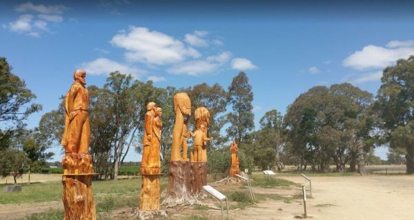
The Father Woods Park is just off the Riddoch Highway, featuring Chainsaw wood carvings and History of to a priest called Father Woods, who spent 10 years during the 1800's, in this local vicinity, and also carvings of Mary Mackillop another prominent per ...
,
The Fitzgerald Bay Camping Areas are all in designated locations with nice views of the bay. There are no facilities so make sure you bring everything you need and take your rubbish with you when you leave. Fitzgerald Bay Camping Areas location map
,
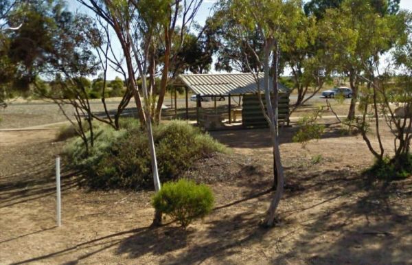
The Forestry Information Stop is set back a short distance from the Riddoch Highway along the Bookers Lane and amongst some large trees that offer plenty of shade. Entrance to the Forestry Information Stop Forestry Information Stop location map
,
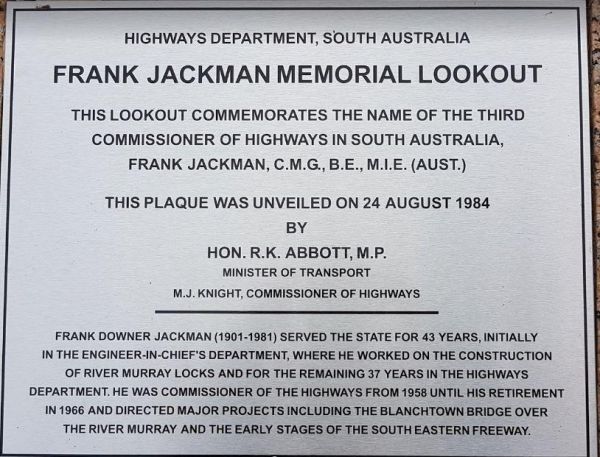
Frank Jackman Memorial Lookout is located on an asphalt circular drive, with a few trees, picnic tables and rubbish bins along its length. Entranced to the Frank Jackman Memorial Lookout Frank Jackman Memorial Lookout location map
,
The Freds Landing Rest Area is nestled between the Murray River and the Princes Highway. There is plenty of room to park your caravan, there are not many shade trees to park under, but there is a public toilet, picnic tables, and rubbish bins, and those i ...
,  ,
,  , , , ,
The Geranium Rest Area is just off the Mallee Highway, with limited shade, a picnic table under some trees for shade and a rubbish bin. There is plenty of room to park your caravan here. The nearest public toilets are located at the town oval. Entrance t ...
,
The Gilles Downs Rest Area 1 is located on the verge of the Eyre Highway. Here there is plenty of room to park your caravan on the gravel surface. There are some picnic tables and rubbish bins along this res area. Entrance to the Gilles Downs Rest Area 1 ...
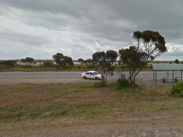
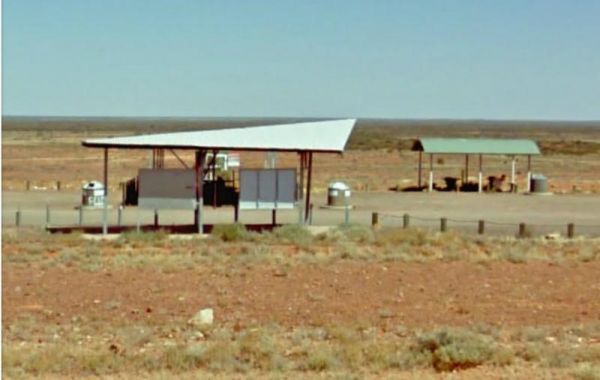
The Rest Area Stuart Highway South Bound is a rest spot in the middle of nowhere. There is an undercover picnic table and rubbish bins. bins. There's not a lot to do here, but you will get lovely sunsets. Entrance to the Glendambo Rest Area South Bound ...
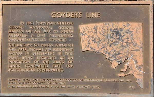
The Goyder's Line Memorial Rest Area, has a memorial to George Woodgroff Goyder. He marked a line on the South Australian map in 1865, which sets what is regarded as the limits of what was considered safe for agricultural development. Entrance to the Goy ...
The Half Way Rest Area Entrance to the Half Way Rest Area Half Way Rest Area location map
The Halidon Rest Area is a gravel area with some shade, picnic tables and rubbish bins. The rest are is set back a short distance from the Karoonda Highway. Entrance to the Halidon Rest Area Halidon Rest Area location map
The Hancocks Lookout Rest Area Entrance to the Hancocks Lookout Rest Area Hancocks Lookout Rest Area location map
The Hanson Rest Area is a large gravel are which can take all sized caravans. The rest are is set back a reasonable distance from the Barrier Highway, and just off West Road. Entrance to the Hanson Rest Area Hanson Rest Area location map
,
The Hesso Rest Area is on the edge of the Stuart Highway and a Railway line. There is no shade or any facilities at this rest spot. You will also get a lot of traffic noise do to this location next to the main highway Entrance to the Hesso Rest Area H ...
The Ingomar North Rest Area is a large gravel area, with plenty of room for all sized caravans. There is an undercover picnic table and some rubbish bins here also. The scenery is almost featureless, apart from the hills in the distance. Entrance to the ...
The Ingomar Rest Area is set back from the Stuart Highway on a gravel surface. There are undercover picnic tables and rubbish bins located here. A rainwater runoff tank offers emergency water, but don't rely on it. Entrance to the Ingomar Rest Area In ...
,
The Iron Knob East Rest Area Entrance to the Iron Knob East Rest Area Iron Knob East Rest Area location map
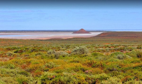
The Island Lagoon Lookout is next to the Sturt Highway on a gravel road base. There are no toilets or amenities here but a nice photo opportunity to capture a salt lake with an Island rising from it. Entrance to the Island Lagoon Lookout Island Lagoon ...
The Island Lagoon Rest Area is on the edge of the Stuart Highway with plenty of room to park dozens of caravans and not be close to each other. There are a couple of picnic tables and rubbish bins available here. Entrance to the Island Lagoon Rest Area ...
The James Ainsworth Horrock Monument Rest Area is set back behind a small stand of trees that offer some shade. This rest area has a picnic table and a monument to James Ainsworth Horrock who was accidentally shot by a kneeling camel while on an expeditio ...
,
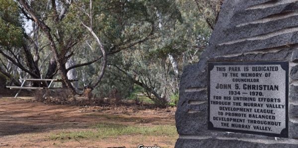
The John S Christian Reserve is is just off Black Hill Road. There are drop toilets and plenty of shade here with reasonably level ground, but not much else. Even though the Marne River is nearby, it will most likely be a dry river bed, so don't bother to ...
, ,
The Karoonda East Rest Area Entrance to the Karoonda East Rest Area Karoonda East Rest Area location map
,
The Keith Park Rest Area has dedicated parking for caravans in Heritage Street. There is a children's playground, a BBQ, plenty of picnic tables and a few rubbish bins, plus a public toilet. Entrance to the Keith Park Rest Area Keith Park Rest Area lo ...
, ,  , , , ,
The Ki Ki South Rest Area is next to the Dukes Highway on asphalt. There are picnic tables and rubbish bins here, plus shome shade, and a few trees separate this rest area from the highway to give a small amount of privacy. Entrance to the Ki Ki South Re ...
,
The Kidnippy Rest Area is set a reasonable distance back from the Eyre Highway with lots of shady spots to choose from, and there are a few rubbish bins onsite This is a very large rest area on a gravel base, so expect a bit off dust from vehicles coming ...
The Kimba East Rest Area has one or two rubbish bins, and a few shady trees to park under. There are also quite a few dirt tracks leading away from the main rest area. But I would suggest you walk along first to see if you can turn around at the end, or y ...
The Kimba Rest Area has a carpark off the Cowell-Kimba Road. A public toilet and a few picnic tables, some shade, and an IGA supermarket across the road, so its a good spot to take a break from driving, and stock up on some supplies for your larder and fr ...
, , , ,
The Kingston South Rest Area is a gravel area set back from the Princes Highway. There is plenty of room to park your caravan, with lots of shade and picnic tables, and rubbish bins. Entrance to the Kingston South Rest Area Kingston South Rest Area lo ...
,
The Koonalda Rest Area is set back a short distance from the Eyre Highway. An undercover picnic table, and a rubbish bin with plenty of room to park, but you will get some road noise, and no shade to park under. Entrance to the Koonalda Rest Area Koon ...

The Koongawa East Rest Area has parking on both sides of the Eyre Highway. A few larger trees offer some shade, rubbish bins and undercover picnic tables, with plenty of room to park your caravan, all on a reasonably flat surface. Entrance to the Koongaw ...
The Koonibba Rest Area is another large gravel area to pull over when your getting tired of driving. There is plenty of room, and some rubbish bins here, reasonably level ground with very limited shade. Entrance to the Koonibba Rest Area Koonibba Rest ...
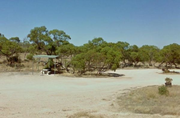
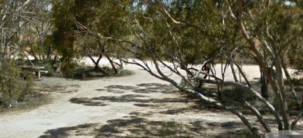
The Kromelite Road Rest Area is located in a forestry setting with room to park your caravan, and plenty of shade and a rubbish bin. Entrance to the Kromelite Road Rest Area Kromelite Road Rest Area location map
The Kyancutta Rest Area is a gravel area just off the Eyre Highway with some limited shade and an undercover picnic table. The Kyancutta Store is within easy walking distance if you need to stop up on a few items for the larder. Entrance to the Kyancutta ...
The Lake Bonney Rest Area is on the shoreline of Lake Bonny, this is a nice spot to have a picnic, and it's not far from the Barmera North Lake Caravan Park. Entrance to the Lake Bonney Rest Area Lake Bonney Rest Area location map
,
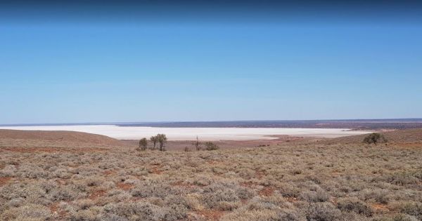
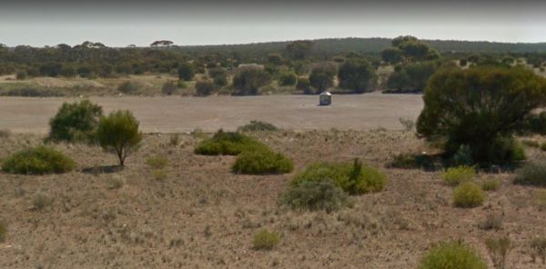
The Lake Hart Rest Area and Lookout is just a short distance off the Stuart Highway on a gravel road to a large area overlooking Lake Hart. There are picnic tables and rubbish bins here, and Don't get your hopes up if you want to go fishing, Lake Hart sel ...
The Leigh Creek Junction Rest Area is just off The Outback Way on a gravel road with limited shade and rubbish bins. Leigh Creek itself is a former coal-mining town. Entrance to the Leigh Creek Junction Rest Area Leigh Creek Junction Rest Area locatio ...
The Tanks Rest Area Entrance to Lincoln Eyre Highway Junction Rest Area Lincoln Eyre Highway Junction Rest Area location map
The Little Blue Lake Rest Area Entrance to the Little Blue Lake Rest Area Little Blue Lake Rest Area location map
,
The Lochiel South Rest Area is set back from the Princes Highway with a few large trees offering some shade, overlooking Lake Bumbunga. The gravel surface is reasonably level and there is an undercover picnic table and rubbish bins here also. Entrance to ...
,
The Lyrup Turn Off Rest Area Entrance to the Lyrup Turn Off Rest Area Lyrup Turn Off Rest Area location map
,
The Mambray Creek Rest Area has plenty of room to park. Check out the Old Mambray Creek rail bridge while your there. There are undercover picnic tables, rubbish bins and plenty of shade to park under. There is a rest are on both sides of the road and pic ...
,
The Manna Hill Park Rest Area Entrance to the Manna Hill Park Rest Area Manna Hill Park Rest Area location map
, ,
The Marla South Rest Area is a large gravel area with an undercover picnic table and a few rubbish bins. The rest area has plenty of room to stop and park safety here, and it's not far from Jims Swamp, but don't get too excited at the prospect of water, a ...
The Marryat Creek North Rest Area is set back a short distance from the Stuart Highway, with undercover picnic tables, rubbish bins, and plenty of off road parking. There is no water here so make sure you have plenty with you. Entrance to the Marryat Cre ...
The Marryat Creek Rest Area is set back a short distance from the Stuart Highway, with undercover picnic tables, rubbish bins, and an emergency supply of rainwater in a tank, which may contain nothing, so make sure you have plenty of water with you. Entr ...
,
The Maslin Rest Area is a Large dusty open flat area, just off the Stuart Highway with an undercover picnic table and a few rubbish bins. shade is almost no existent. Entrance to the Maslin Rest Area Maslin Rest Area location map
The Mathesons Bore Rest Area is on a gravel track 300 metres from the Stuart Highway, there's not a lot to do here but it is a popular rest stop nonetheless. Entrance to the Mathesons Bore Rest Area Mathesons Bore Rest Area location map
The Meningie Lions Jubilee Park has some shops within walking distance from here. You can try some beach fishing or from the small jetty at high tide. Or simply take a nice walk along the sandy shoreline. Entrance to the Meningie Lions Jubilee Park Me ...
, , ,
The Meningie South Rest Area just off the Princes Highway and very easy to miss, I personally would think twice before commiting my van down this rest area track, it seems like it is seldom used. Entrance to the Meningie South Rest Area Meningie South ...
The Merriton North Rest Area runs alongside the Augusta Highway for quite some distance, with plenty of room for all sized rigs. There are rubbish bins and undercover picnic tables, and a bit of shade, and being close to a main highway some traffic noise. ...
,
The Millicent North Rest Area is a nice shaded area just off the Princes Highway, with picnic tables and rubbish bins. There is plenty of room to park all sized caravans on a reasonably flat surface. Entrance to the Millicent North Rest Area Millicent ...
,
The Millicent South Rest Area is off the Princes Highway with room for most sized caravans. A fair bit of shade to choose from and some rubbish bins, and road noise from the adjacent highway. Entrance to the Millicent South Rest Area Millicent South R ...
The Mingary Siding Rest Area Entrance to the Mingary Siding Rest Area Mingary Siding Rest Area location map
The Monalena Lagoon Rest Area has an undercover picnic table, rubbish bins and an emergency supply of collected rainwater in a water tank. You also have plenty of room to park, without crowding others here. Entrance to the Monalena Lagoon Rest Area Mo ...
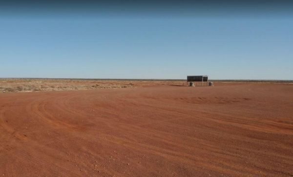
The Montecollina Bore Free Camping Area has no facilities but a great place to camp nonetheless. The Hot water from the bore can put into your outdoor shower bucket. The Montecollina Bore Montecollina Bore Rest Area location map
The Montieth Rest Area is set back from the Princes Highway with a few different areas to park. There is some shady trees available here, and a little bit of privacy but not much else. Entrance to the Montieth Rest Area Montieth Rest Area location map ...
The Moralana Creek Rest Area is set well back from The Outback Highway. This rest spot is a large level gravel area with only one tree to give you some shade so first in gets the limited shade. There are a few distant mountains to look at while you take a ...
The Morambro Creek Rest Area is set back from the Riddoch Highway amongst some shady trees and picnic tables. The Morambro Creek runs along this rest spot, but no guarantee there will be any water in it. Entrance to the Morambro Creek Rest Area Moramb ...
,
The Morgan Road Rest Area is back from the Goyder Highway on reasonably level ground. There is plenty of shade, a picnic table and a few rubbish bins. Entrance to the Morgan Road Rest Area Morgan Road Rest Area location map
,
The Morgan West Rest Area is set back off the Thiele Highway, there are a few trees for shade on reasonably level ground, This is another place to take for a rest from driving. Entrance to the Morgan West Rest Area Morgan West Rest Area location map
The Mount Bryan Rest Area is opposite the Mount Bryan Hotel, and the General Store, with public toilets, rubbish bins, and picnic table under some shady trees and BBQ's. There is plenty of room to park even the largest of motorhomes, and caravans. Overall ...
, , ,
The Mount Dutton Bay Rest Area is right next to the water's edge. There is a public toilet block here, and room to park your caravan, and Please keep the boat ramp area clear at all times. Entrance to the Mount Dutton Bay Rest Area Mount Dutton Bay Re ...
, ,
The Mount Whyalla Rest Area is wedged between the Lincoln Highway and the railway line. There is some shade and rubbish bins and picnic tables here. There is also plenty of room to park your caravan of motorhome. Entrance to the Mount Whyalla Rest Area ...
The Mt Bryan Rest Area is just off the Barrier Highway on a gravel surface. There is plenty of room to park your caravan or motorhome, there is some shade, rubbish bins and BBQ, all directly across the road from the Hotel. Entrance to the Mt Bryan Rest A ...
, , ,
The Mulga Well North Rest Area is a level gravel area with rubbish bins and an undercover picnic table. This rest spot is set back a reasonable distance from the Stuart Highway. But there's not a lot to do here to keep you entertained. Entrance to the Mu ...
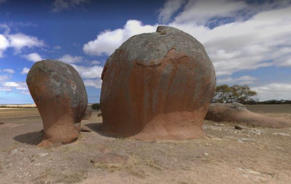
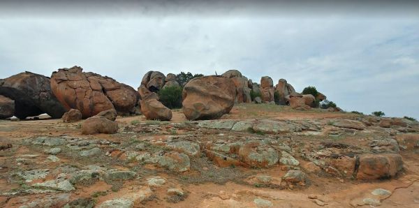
The Murphy's Haystacks Park Rest Area has room to park your caravan, and there is a well defined path for you to go and explore this unusual rock outcrop. Entrance to the Murphy's Haystacks Park Rest Area Murphy's Haystacks Park Rest Area location map ...
,
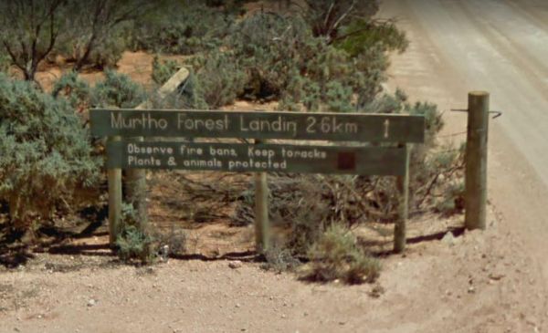
The Murtho Forest Landing Campground has quite a few camping spots very close to the Murray River. Grab your fishing line and see how you go, or drop your kayak in the water for a short exploration paddle. Entrance to the Murtho Forest Landing Campground ...
, , ,
The Nackara East Rest Area is back a fair distance from the Barrier Highway, with a few trees for shade. Entrance to the Nackara East Rest Area Nackara East Rest Area location map
The Nooltana Creek Rest Area is slightly elevated from the Barndioota Road which runs below it. There are a few trees for shade and a rubbish bin. You can expect a few truck's to stop here, but there is plenty of room for your motorhome or caravan, and yo ...
,
The North Tent Hill Rest Area is a large flat and dusty area on the edge of the Stuart Highway. There is a small amount of shade, an undercover picnic table and a few rubbish bins. There is plenty of room for caravans and motorhomes. Entrance to the Nort ...
The Nullarbor Rest Area is a short hop from the Eyre Highway with Ocean Views. There is a fair amount of room to park your caravan, and stretch your legs. Entrance to the Nullarbor Rest Area Nullarbor Rest Area location map
Entrance to the Nullarbor Truck Stop Rest Area Nullarbor Truck Stop Rest Area location map
The Nundroo East Rest Area is on reasonably flat gravel a short distance from the Eyre Highway, with some shade trees, picnic tables and rubbish bins. There are a few tracks that head further away from the main road for the more adventurous of you. Entra ...
The Olary Creek Rest Area Entrance to the Olary Creek Rest Area Olary Creek Rest Area location map
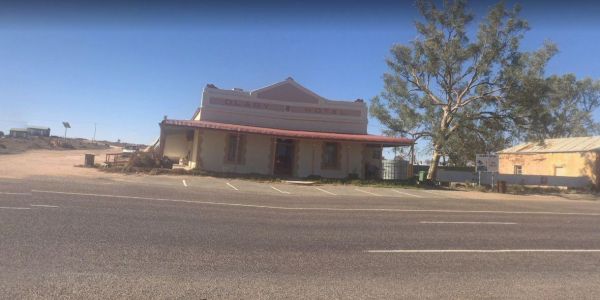
The Olary Rest Area has a fair bit of room to park your caravan, with a public toilet and some rubbish bins. You can also pop over the road to the pub for a meal. Entrance to the Olary Rest Area Olary Rest Area location map
,
The Old Perlubie School Rest Area is back from the Eyre Highway with low scrub surrounding this rest area with a few suitable level spots to pop the caravan into. Entrance to the Old Perlubie School Rest Area Old Perlubie School Rest Area location map ...
The Oodla Wirra South Rest Area Entrance to the Oodla Wirra South Rest Area Oodla Wirra South Rest Area location map
The Orroroo Rest Area runs next to the Wilmington-Orroroo Road with a few trees for shade, rubbish bins, and picnic tables, this is another rest area to pull over when your tired from driving.campervans easily. Entrance to the Orroroo Rest Area Orroro ...
,
The Padthaway North Rest Area is a gravel road that runs parallel to the Riddoch Highway. There are low trees for shade, and undercover picnic tables, plus some rubbish bins located here. and most of this rest area, is quite flat to park on. Entrance to ...
,
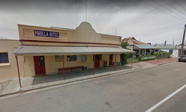
The Parilla Rest Area is in the Parilla township just off the Mallee Highway. There are undercover picnic tables, a few rubbish bins, and public toilets, the Parilla Hotel is directly opposite this rest area. Entrance to the Parilla Rest Area Parilla ...
, ,
The Parrakie Rest Area Entrance to the Parrakie Rest Area Parrakie Rest Area location map
,
The Peake Creek Siding Rest Area is just off the Oodnadatta Track, shade is limited, but you can park quite close to the Peake Creek. The water in the creek is very salty, so you will need an Osmosis desalination plant if you intend to drink it. Peake Cr ...
The Peake Rest Area Take a break from giving and walk over to the Silos and take a photo, this rest area has Rubbish bins provided. You can also walk to the Overlander Tavern and grab a bite to eat. Entrance to the Peake Rest Area Peake Rest Area loca ...
,
The Penong East Rest Area is a small oasis of trees on the edge of the Eyre Highway. There are a few small trees for shade and picnic tables and rubbish bins for your convenience. Entrance to the Penong East Rest Area Penong East Rest Area location ma ...
The Peterborough Rest Area is wedged between Peterborough Road and McNamara Road. The rest area has some shady trees to park under, picnic tables, and rubbish bins, plus plenty of room to park your caravan or motorhome. Entrance to the Peterborough Rest ...
,
The Police Heritage Monument Rest Area is reasonably level but not much between you and the Sturt Highway to stop traffic noise. There is also a gravel parking area on the opposite side of the Sturt Highway for those heading in the opposite direction. En ...
,
The Poochera Rest Area is on the a gravel surface on the edge of the Eyre Highway, there are a few rubbish bins and plenty of parking space for your caravan. Entrance to the Poochera Rest Area Poochera Rest Area location map
The Pootnoura Rest Area is set back from the Stuart Highway with an undercover picnic table, plenty of space to park your caravan an emergency water supply, plus an emergency phone if your in trouble. As always, its best to boil water from an unknown supp ...
,
The Port Germein South Rest Area is on both sides of the Princes Highway with plenty of room to park your caravan, there are rubbish bins and undercover picnic tables. Entrance to the Port Germein South Rest Area Port Germein South Rest Area location ...
The Port Minlacowie Boat Ramp is off the George Mumford Road, if you intend to stop here for an hour or so to take in the views of the Spencer Gulf. Please keep access to the boat ramp clear for the locals. Entrance to the Port Minlacowie Boat Ramp Po ...
, ,
The Port Neill South Rest Area is just off the Lincoln Highway on a gravel road, with some shade, picnic tables and a rubbish bin. Entrance to the Port Neill South Rest Area Port Neil South Rest Area location map
,
The Port Wakefield South Rest Area is just off the Princes Highway, on a reasonable level gravel surface. There are a few low trees for shade and an undercover picnic table plus some rubbish bins here. Entrance to the Port Wakefield South Rest Area Po ...
The Puntabie East Rest Area is a fairly level gravel area just off the Eyre Highway with some small trees for shade. There are picnic tables and some rubbish bins, and a few tracks leading further away from the highway for the more adventurous out there. ...
,
The Ranges View Rest Area is a Large dusty open flat area, just off the Stuart Highway with an undercover picnic table and a few rubbish bins. and an information wall which is also under cover. Entrance to the Ranges View Rest Area Ranges View Rest Ar ...
The Red Banks Rest Area is down a bumpy dirt road, with parking for around 6 caravans, but the cliffs have been deemed unstable, so I'm not sure if camping is allowed anymore. Entrance to the Redbanks Rest Area Red Banks Rest Area location map
,
The Reedy Creek South Rest Area is a small oasis of trees on the side of the Princes Highway, offering some shade from the sun and a place to rest a while, before heading off to your next oasis. Entrance to the Reedy Creek South Rest Area Reedy Creek ...
,
The Rest Area Stuart Highway South Bound a is set back a sort distance from the Stuart Highway. This is a large level rest area with a few rough tracks leading further away from the main road for a bit more privacy. There is an undercover picnic table and ...
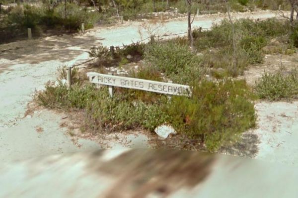
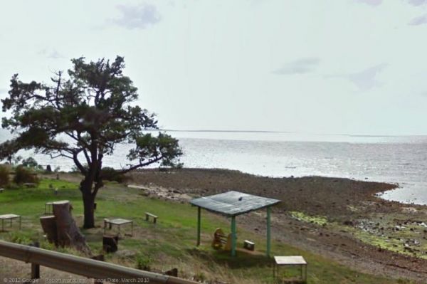
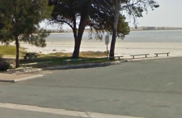
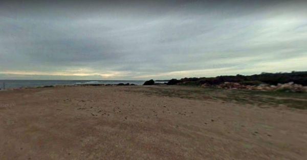
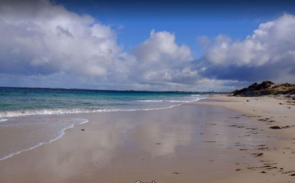
The Ricky Bates Reserve is just off Dolphin Drive on the water's edge. This spot is fairly secluded spot.Please Note: No Overnight stays permittedNOTE: There are a few low cost camp sites available not far away, my Dutton bay woolshed, Farm beach. Shelly ...
,
The Riverton South Rest Area runs for quite a long way parallel to the Barrier Highway . There is plenty of shady spots to stop under, and picnic tables between the rest area and the main road. Entrance to the Riverton South Rest Area Riverton South R ...
,
The Saddleworth Rest Area Reasonably level ground located just off the Barrier Highway, and backs onto the Gilbert River, which may or may not have any water in it. overall its an OK spot for a BBQ or Picnic. Entrance to the Saddleworth Rest Area Sadd ...
, ,
The Saddleworth Rest Area 2 is just off the Barrier Highway on a gravel surface. There are a few low trees offering limited shade, and a rubbish bin. There's not a lot to do here apart from having a rest from driving. Entrance to the Saddleworth Rest Are ...
The Sandleton Fruit Fly Rest Area has plenty of room to park your caravan and motorhome. This rest spot is just off the Sturt Highway, with lots of small trees, picnic tables and rubbish bins. Entrance to the Sandleton Fruit Fly Rest Area Sandleton Fr ...
,
The Sheringa Rest Area is big enough for all sized caravans and motorhomes. This rest spot is on the edge of the Flinders Highway with a few small trees for shade, a picnic table and rubbish bin. Entrance to the Sheringa Rest Area Sheringa Rest Area l ...
The Snowtown North Rest Area is set back a short distance from the Augusta Highway. There are small trees offering some shade, and also separating you and the Highway. An undercover picnic table and rubbish bins, plus plenty of room to park your caravan o ...
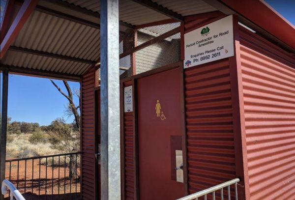
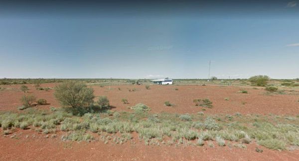
The South Australia - Northern Territory Border Rest Area is a 24 hour camping area that has an asphalt car park set up nicely for cars with caravans. There are public toilets and a few rubbish bins, but shade is rather limited. You can also camp on the o ...
, , ,
The Spalding Junction Rest Area is a shady spot for a picnic, there is a picnic table, rubbish bins and some shade. The ground is reasonably level for parking your caravan just off the Barrier Highway. Entrance to the Spalding Junction Rest Area Spald ...
The Springs Road Rest Area is on the edge of the Southern Ports Highway. This rest spot has a picnic table, rubbish bin, and a bit of shade, plus its a reasonably level area to pop the van on. Lake Eliza is approx 900 metres, and there is a walking track ...
,
The Stockwell Rest Area is a small loop gravel driveway just off the Sturt Highway. There is room to park any sized rig here, but ground is not level, you will also find a rubbish bin and some limited shade, but not much else. Entrance to the Stockwell R ...
,
The Stockyard Plain Rest Area is a slightly elevated rest spot running alongside the Sturt Highway. Shade is very limited, but there is an undercover picnic table and rubbish bins, and reasonably level ground to park your caravan. Entrance to the Stockya ...
,
The Tailem Bend South Rest Area is a fairly large rest area just a short drive up a gravel road from the Princes Highway. There is room to park your caravan, a few trees for shade and not much else. Entrance to the Tailem Bend South Rest Area Tailem B ...
The Tantanoola East Rest Area is an asphalt strip running alongside the Princes Highway. The Tantanoola Roadhouse is directly opposite, and has good fuel prices and food. Entrance to the Tantanoola East Rest Area Tantanoola East Rest Area location map ...
The Tarcoonyinna Rest Area is a large gravel area, set back a fair distance from the Stuart Highway. It's suitable for all sized rigs, shade is extremely limited here, with an undercover picnic table and rubbish bin, in the the middle of a barren landscap ...
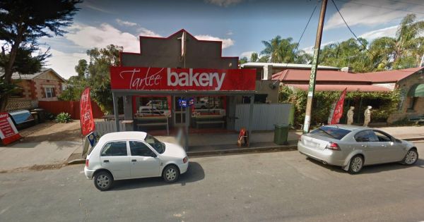
The Tarlee Park Rest Area is off the Main North Road, with plenty of room to park all sized vehicles. There is a public toilet and picnic table and rubbish bins. If you stop here why not pop over the road to the local bakery. Entrance to the Tarlee Park ...
, ,
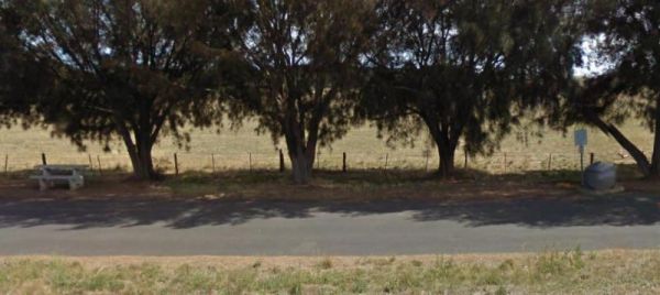
The Tarlee Rest Area is set back from the Main North Road on a stretch of asphalt from the Old Gilbert Bridge, with a few trees for shade, and nothing else, but it is a level road with room to park your caravan. Entrance to the Tarlee Park Rest Area T ...
,
The Tcharkulda Rock Rest Area has a gas bbq, public toilets, an old stone hut with fireplace and some history to it. While your here be sure to checkout the wall that was built to catch the run off from the rock, to the reservoir. Tcharkulda Rock Rest Ar ...
, ,
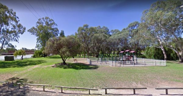
The Bert Dix Memorial Park Area is lovely spot on the Murray River. You have BBQ''s, picnic tables a few rubbish bins, and a nice childrens playground. There is plenty of room to turn around with your caravan, this is a really nice place to spend a n hour ...
, , , , , , , ,
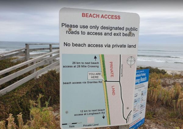
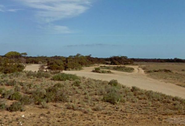
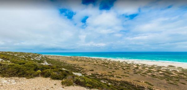
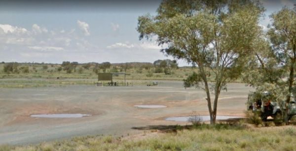
The Granites Parking Area has been revamped with a larger area for camping. From here you can drive on the beach and drive along the beach for 12k to Longbeach Road, or 26k in the other direction to the 28 Mile Crossing beach exit area. Be sure to keep an ...
, ,
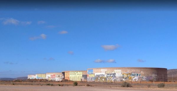
The Tanks Rest Area Entrance to The Tanks Rest Area The Tanks Rest Area location map
The TM Price Rotary Park Rest Area is just off the Sturt Highway with off-road parking on the other side of the reserve for self contained motorhomes, there is a 24 Hour Limit imposed and No Caravans permitted. Entrance to the TM Price Rotary Park Rest A ...
, , , ,
The Wangary Rest Area is reasonable level and just off the Flinders Highway, pop in and have a picnic at the undercover picnic table area. Entrance to the Wangary Rest Area Wangary Rest Area location map
,
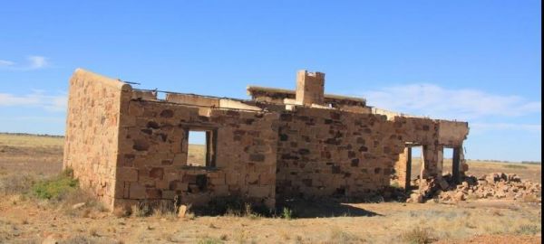
The Warrina Siding is a short distance from the Oodnadatta Track and an easy walk to the Old Ruins, but make sure you are well stocked with water, fuel and food, as this is an unforgiving area you are visiting, it's always advisable to let someone know wh ...
The Warrow North Rest Area is on a large gravel surface on the corner Ulina Lane and Flinders Highway. There is an undercover picnic table, and a few rubbish bins, and room to park your caravan. Entrance to the Warrow North Rest Area Warrow North Rest ...
The Watraba Rest Area is just off the Eyre Highway, it's a larger gravel area that is reasonable level. There is plenty of room to park your caravan, but very little shade, some rubbish bins and picnic tables. You can also sit and watch the traffic go by, ...
The Wawirra Creek Rest Area is nestled between the Railway and the Barrier Highway, there is an undercover picnic table and rubbish bin to greet you here, and quite a large area to pull into, and take a rest from driving. Entrance to the Wawirra Creek Re ...
The Wharminda Soaks Picnic Area is just off Soaks Road, there is a public toilet, and a bit of room to park your caravan, and enjoy a nice picnic. Wharminda Soaks Picnic Area location map
,

The Willalooka Park Rest Area is set back from the Riddoch Highway, with a public toilet, some rubbish bins, and picnic tables. This rest spot is in front of the Riddoch Hall, and its a short walk to the Willalooka Tavern for those so inclined. Entrance ...
, , , ,
The Winavon Rest Area is a gravel strip running alongside the Riddoch Highway. There is some shade, rubbish bins and an undercover picnic table, and plenty of room to park your caravan. Entrance to the Winavon Rest Area Winavon Rest Area location map ...
,
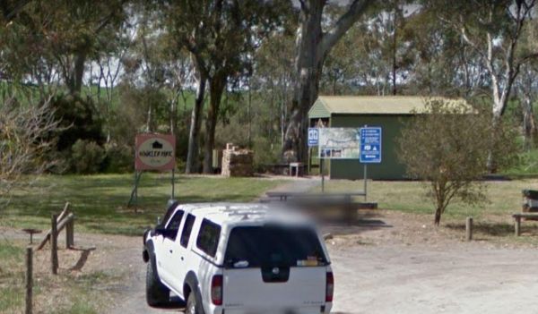
The Winkler Park Rest Area is just off the Barrier Highway, and backs onto the Gilbert River, there are toilets, and a few picnic tables. There is also a sign pointing to where you can park your caravan. Entrance to the Winkler Park Rest Area Winkler ...
, , ,
The Winnininnie Creek Rest Area Take a walk along the Dry Creek bed, and remember to take water with you. it gets mighty hot. Entrance to the Winnininnie Creek Rest Area Winnininnie Creek Rest Area location map
The Wintinna Rest Area is set back a short distance from the Stuart Highway on a gravel surface. There is an undercover picnic table and some rubbish bins and not much else. There is plenty of room to park your caravan. Entrance to the Wintinna Rest Area ...
The Wirrulla West Rest Area is a gravel area just off the Eyre Highway, with a few rubbish bins, and low shrubs for a little bit of shade. Entrance to the Wirrulla West Rest Area Wirrulla West Rest Area location map
The Woolshed Flat Rest Area is a reasonably flat area just off the Flinders Ranges Way, with plenty of room to park any sized caravan. Entrance to the Woolshed Flat Rest Area Woolshed Flat Rest Area location map
The Wudinna East Rest Area is a gravel area just on the edge of Eyre Highway. There's not a lot to do here, apart from take a break from driving. Entrance to the Wudinna East Rest Area Wudinna East Rest Area location map
The Yalata West Rest Area is a large grave surface to park you caravan on. It's just off the Eyre Highway, and there are a few tracks to take you further away from the highway, to more secluded campsites. Entrance to the Yalata West Rest Area Yalata W ...
The Yantanabie South Rest Area has limited shade but plenty of room to park your caravan on the large gravel area just off the Eyre Highway. There is a picnic table under some small trees, and some rubbish bins, and that sums this rest spot up. Entrance ...